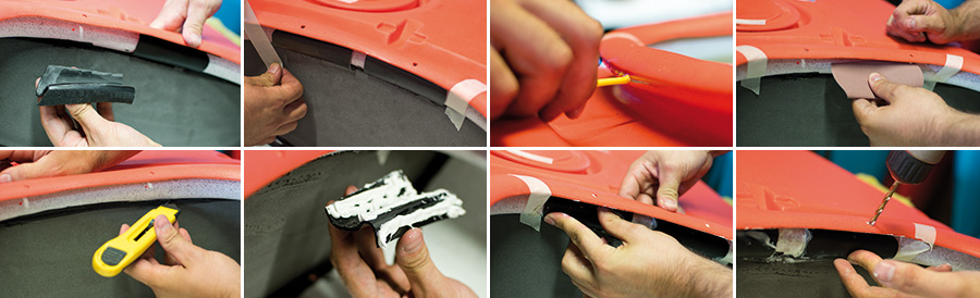
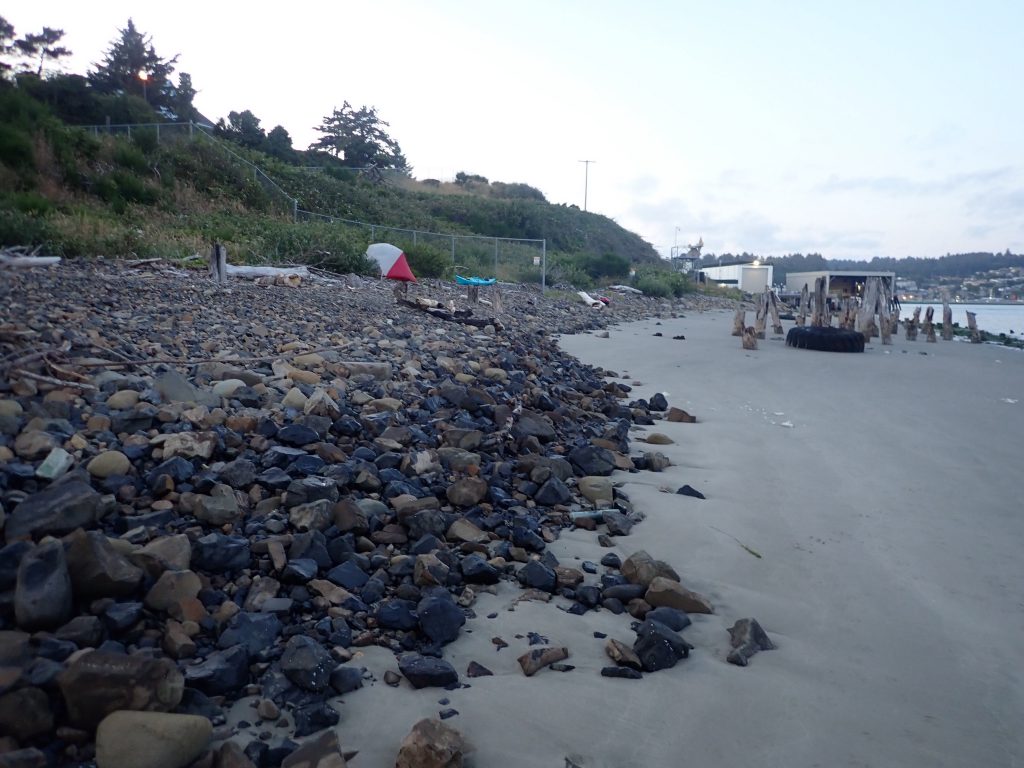
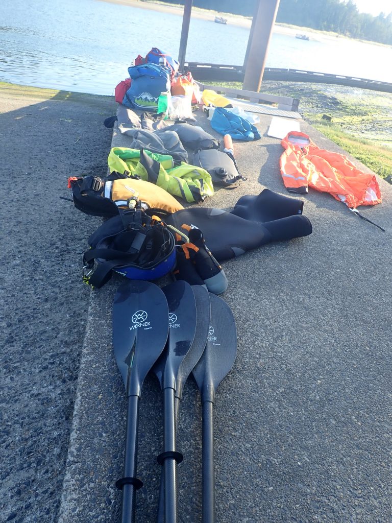
We recently became aware of a number of polyethylene P&H Sea Kayaks which had insufficient thickness towards the rear of the cockpit rim and were therefore more prone to splitting in this area.
Affected batches were produced in late 2019/early 2020; you can ascertain the production date of your kayak by looking at the last 4 digits of the serial number, with the letter denoting the month (‘A’ being January, ‘B’ being February, and so on) the first number being the last digit of the calendar year, and the final two numbers being the last two digits of the US model year (changing in August).
If you believe your boat to be affected, please email help@pyranha.com with your address, the serial number, model, size, and colour of your kayak, and which dealer it was purchased from.
No other batches are affected, although it is possible that other boats may split in this region for different reasons, such as:
Frequently sitting directly on the back of the cockpit rim.
Transporting the boat with the cockpit rim against an unpadded roof rack.
Storing the boat with the cockpit rim against an unpadded rack.
Extreme or high-frequency usage.
A Cockpit Rim Repair & Reinforcement Kit is available for instances where a cockpit rim split has occurred outside of the warranty duration or conditions.
Over the upcoming months and likely into our next summer season, I’ve decided to pursue a project around what is, in a way, what I call ‘my office’. As we are now drawing toward the end of a fourth season operating Kayak Summer Isles, in the north west of Scotland, I’ve spent many hundreds of days getting to know, sharing, and exploring these islands. It’s safe to say I know them well.
I figure the next step of really embedding myself into the islands is to spend a night on them.
Some of which I do on a regular basis with our guests, but many others (the rocks and skerries) I’ve not even landed on yet. By my count there are 17 ‘proper’ islands and 15 rocks and skerries big enough to safely camp and land on, making a total of 32 nights in the archipelago.
I won’t make them all in a season, as some will mean waiting until the bird colonies move off in winter so I won’t disturb them. What ones I can do now I hope to tackle in ‘evening blasts’ after work and before starting the next day’s guiding.
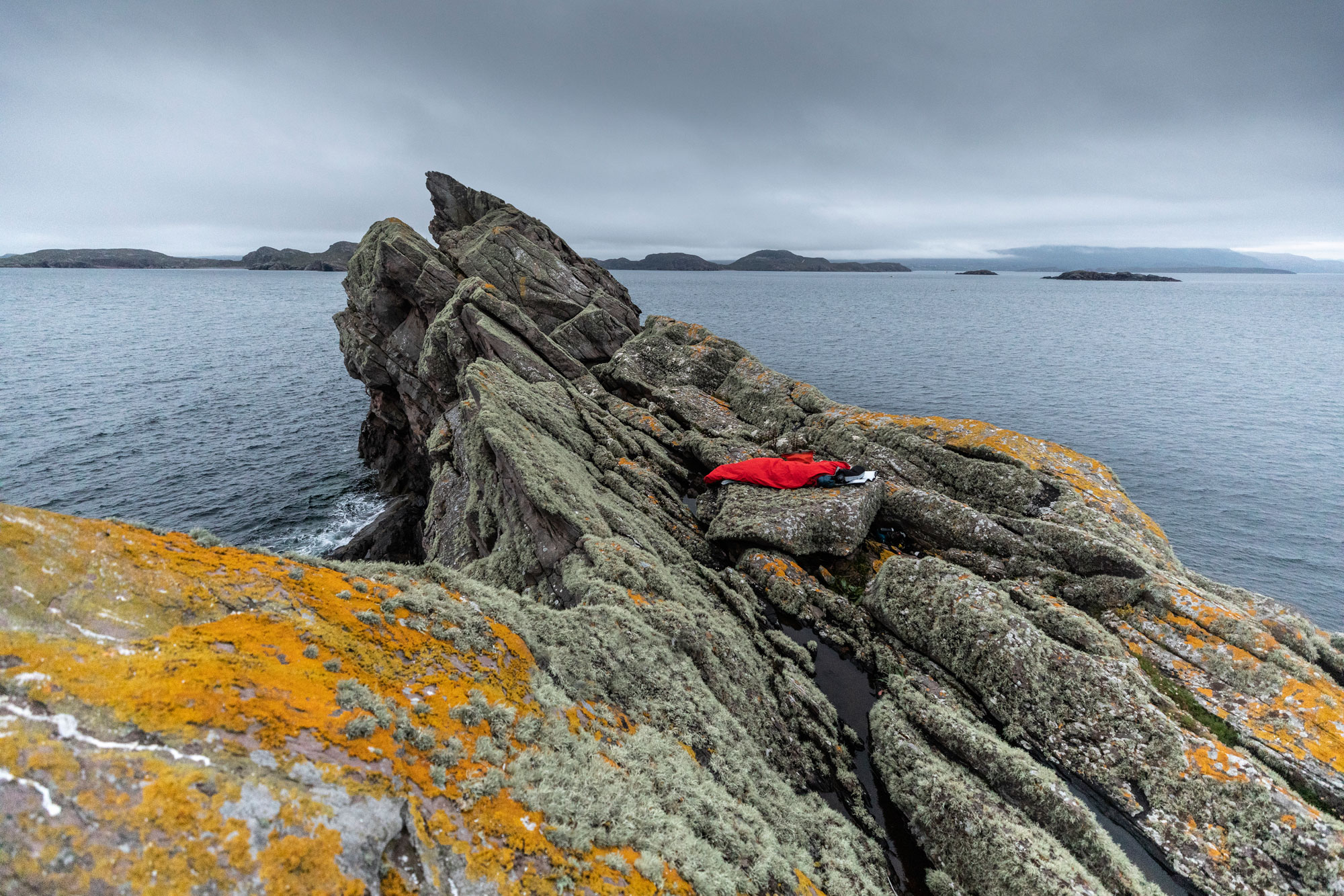
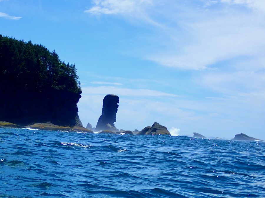
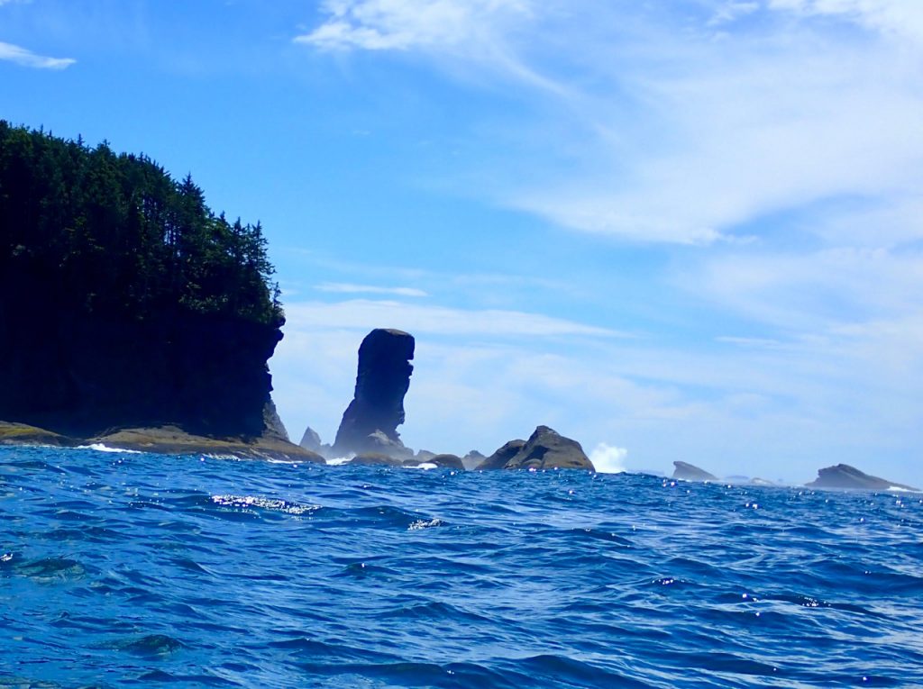
What better way to start than the iconic and rugged skerry that is Stac Mhic Aonghais.
Local legend has it, that the name comes from a man who was laid prisoner on this lonely and desolate rock. Purportedly having had ‘intimate relations’ with a laird’s daughter, he was rowed out and abandoned as a ‘time out and think about what you’ve done’. Ahh, young love.
By day 3 Angus’s captors must have felt guilty, as they then rowed out to check on him. Upon landing they were surprised to discover that Angus had gone!
Combing the island, they strayed further from their boat and with a sudden race, Angus leapt from a crevice in the rocks, hopped aboard and dis-embarked, waving cheery farewell as his captors became the captives.
Some accounts say he rowed, whilst others claim he had no oars and set adrift. Either way, he landed on Stoer Head some 30km north and survived.
The boat still remains with Angus’s relatives, and there’s been bad blood between the two families ever since . . . apparently.
I wonder if he ever managed to meet the laird’s daughter ever again?
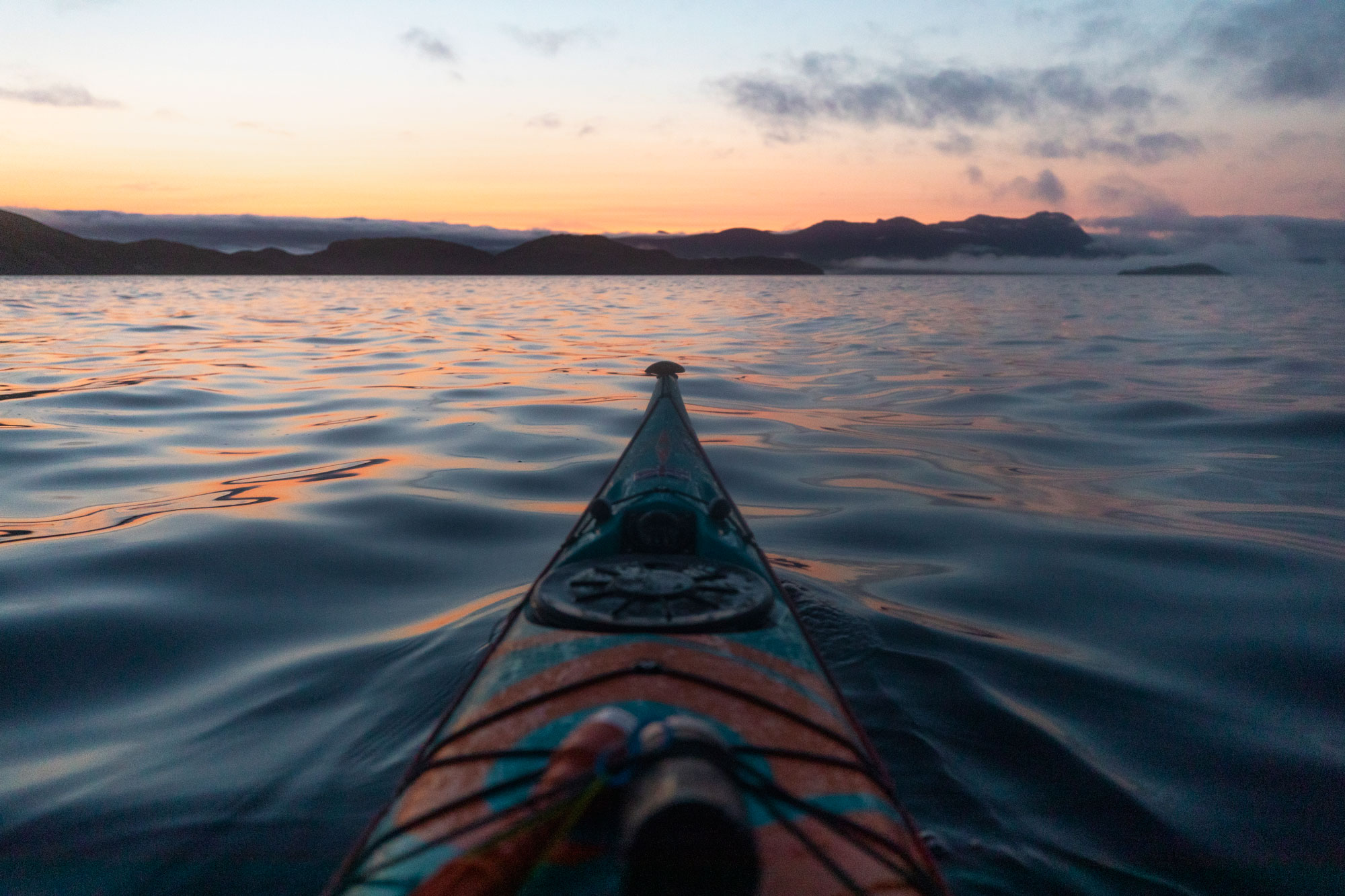
Kayaking out in the evening, I set off from shore around 7.30 pm, with little over an hours light left in the day. I was tired from a day’s guiding but equally excited to disappear for a night’s vagabond adventure, following in Angus’s footsteps for a night on his rock.
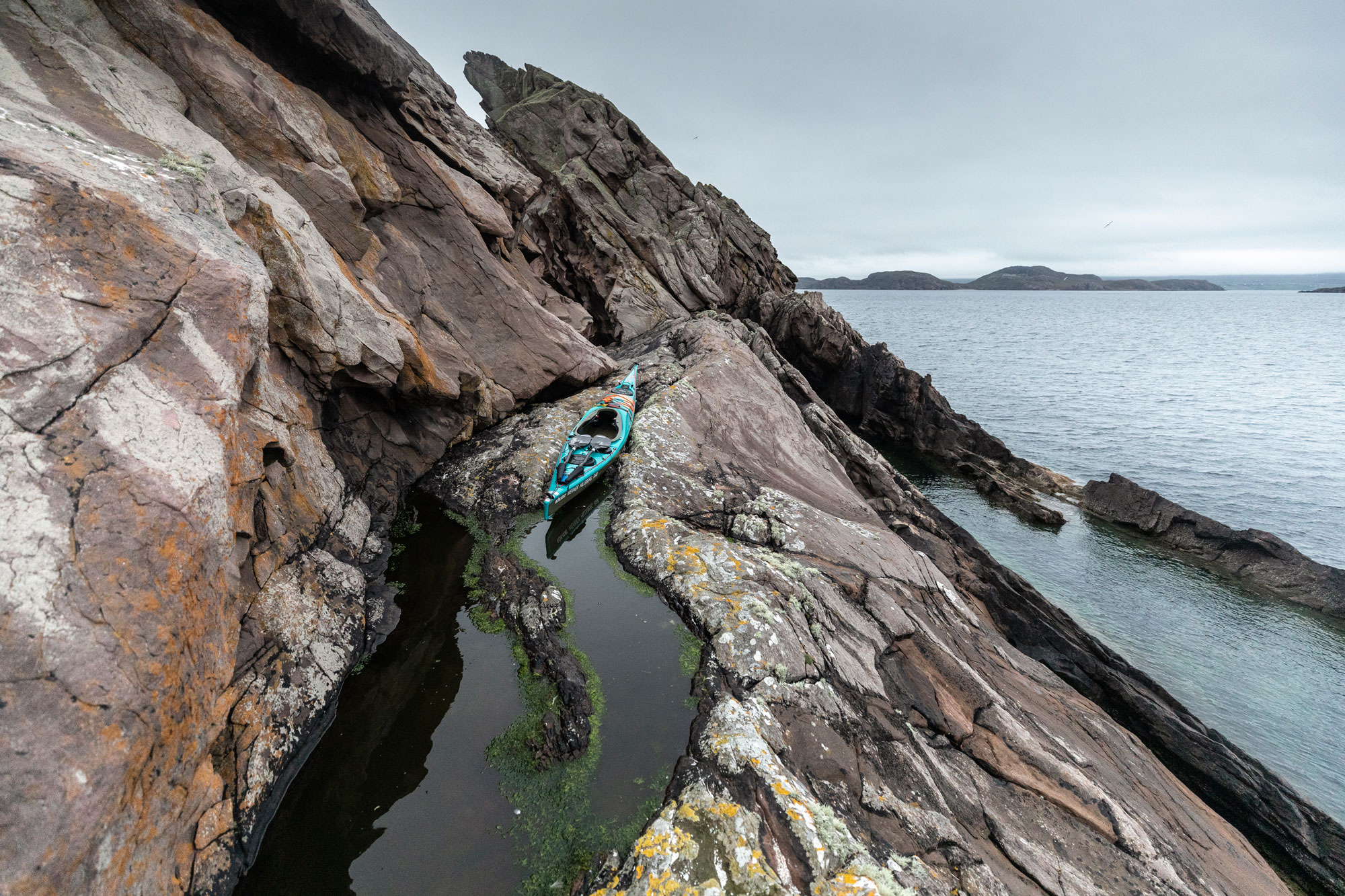
The island is 1km south of Tanera Beag and even with the wind in favour and using the tidal eddies to my advantage, the journey took an hour from Old Dornie Harbour. The light was waning.
I’d taken my ultra-lightweight kevlar/carbon infusion Aries, as I figured it’d be easier to haul up the rocks on my shoulders fully laden with camp and cookware, but in hind-sight maybe a plastic boat that I could have dragged may have been a wiser move. Arriving at high tide, I found a crevice without swell on the eastern shore and set about navigating the 40º sloped sides with the boat on my shoulder. Delicate footsteps and my free hand scrambling brought me up to a ledge where I could at last anchor the kayak.
By necessity, I needed to return early the next morning, meaning leaving at the low tide. Before setting camp, I scouted about and picked my exit route as my prior access would be untenable at the lower tidal state. A scramble, toss, and a leap seemed likely.
The stac was largely rock, with a bristling hair of lichens adorned across the top. Around the corner, on the wind-battered western cliffs, I could hear a bird colony, out of sight but not out of sound.
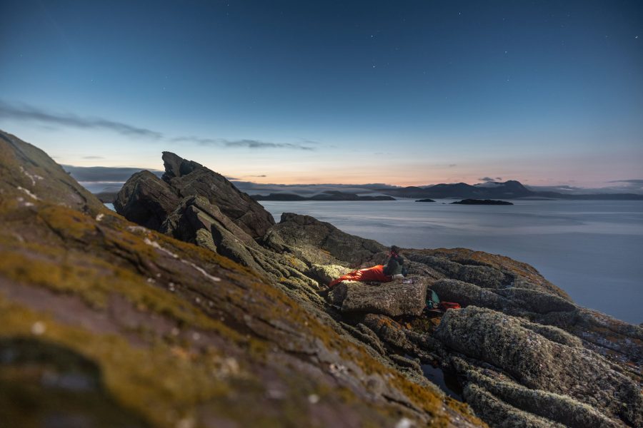
Many, if not all of the possible flat spots were waterlogged with bright green algal pools. To my delight on the summit, a single large flat slab presented a near-perfect bed. Surrounded on all sides by a small rocky lip, it cradled the sense of security atop the island and granted a fantastic view. Darkness was fast approaching.
Bivi bag out on the rock, I scoffed a quick dinner, took a few photos and then settled into bed. The sound of the low swell pounding below me, and the occasional whoosh of birds flying past lulled a sense of calm. The air was warm, and as hoped for a breeze kept any midges at bay.
By 2 am, the full moon had risen, bathing the island in a silvery light, enough to see without a head-torch. 20km to my east, I could see the lights of Ullapool, home, in the distance.
The breeze had dropped, as had the swell, leaving the island eerily calm. Below me, I could hear a pshhht coming from some form of cetacean nearby, most likely a porpoise, but I liked to imagine a whale.
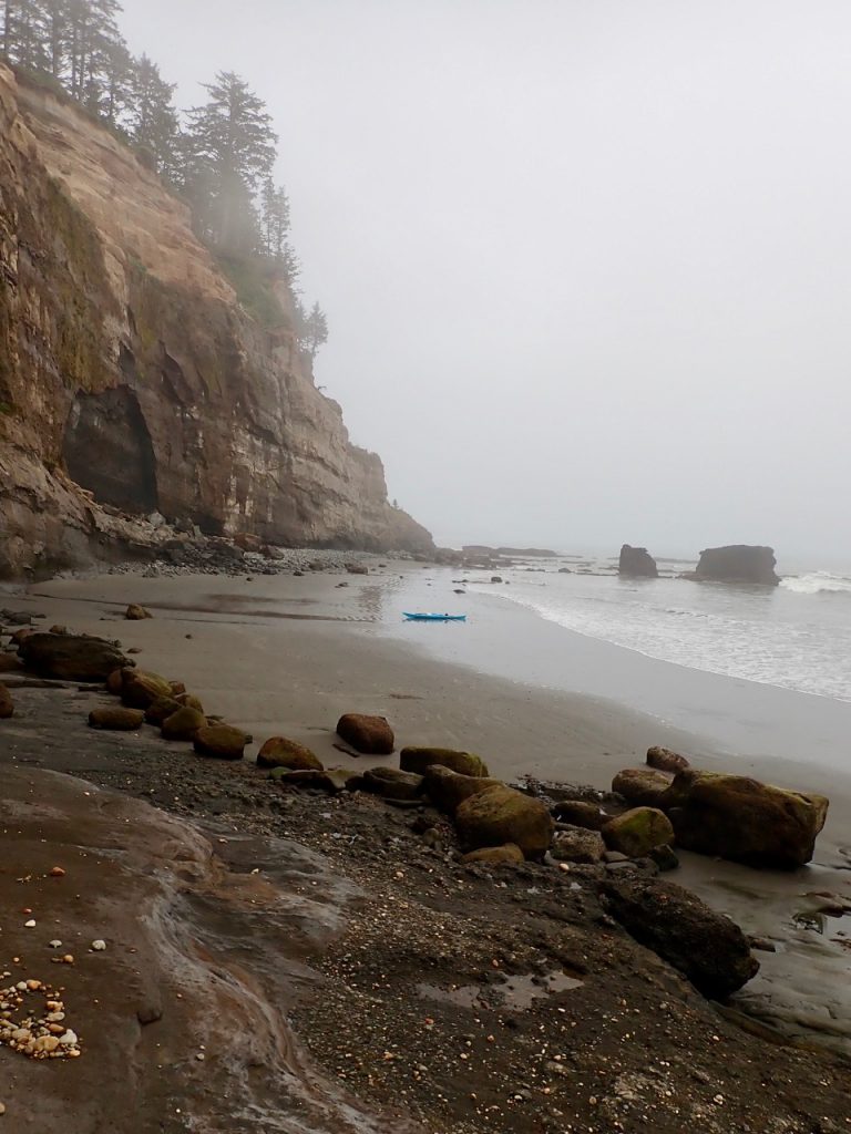
My alarm wasn’t necessary. As it turns out seagulls also wake with the first hint of dawn, and their calls as they fledged their roosts around the corner was sufficient to wake me. A faint orange glow was rising as I re-packed my kayak and carefully carried it down the rocks, thankful for the barnacles to give some grip.
Clipped to my kayak, I tossed it into the gentle swell and leapt aboard under head-torch. Once decked on, I turned my light off, preferring to navigate by the dawn glow. It was 5 am.
Returned to Ullapool before the day begun, I arrived home, showered and packed, ready to re-pack and head back on the water with guests. I felt satisfied like I’d stolen a secret adventure through the night, unseen and unknown until dawn. Most of all however I was thankful not to leave the island and drift north to Stoer, wondering if I’d ever return again.
If you’d like to share my island adventures as I try to camp on each follow me on @willcopestake (Instagram and YouTube) and via #summerislessleeps, or better still, join me through www.kayaksummerisles.com
Having spent much of lockdown reminiscing on past adventures and planning exciting new adventures (the shelf of guidebooks has had to bear the burden of a few new additions since March), we were ready to make the most of the easing of restrictions. One of the new additions to our guidebook collection was Doug Cooper’s Skye and North West Highlands Sea Kayaking. In hindsight, it seems remarkable that it wasn’t already an established and well-thumbed favourite.
With kayaking, adventures, and overnight stays more than 5 miles from home all back on the cards, a plan was forming. It seemed that high pressure was going to dominate the North Coast for at least a few days, and after our enforced time away from the water we wanted a series of day trips with the option of an overnight camp or two.
“A week could easily be spent exploring this area, let alone the islands further south.” – Doug Cooper on the northern-most of the Summer Isles.
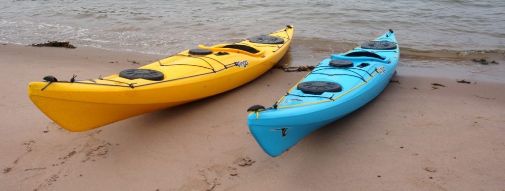
Our plan for a few day trips around the Summer Isles and an overnight camp now formed, the P&H Virgo seemed like the perfect choice: In CoreLite X it would be light for daily lifting on/off the roof of the van; rugged for lots of rocky landings and if the swell picked up some rock hopping; big enough to accommodate our camping kit; maneuverable to allow us to explore the tightest of gaps.
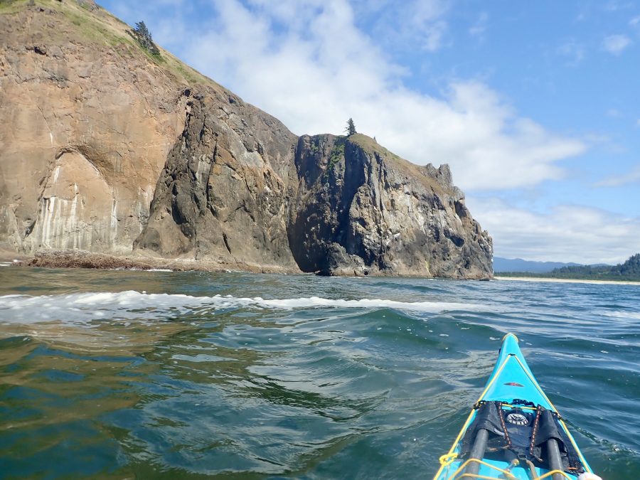
The first few days were spent making day trips in Loch Ewe and around the Summer Isles. Rocky coastlines with imposing cliffs, white sandy beaches, small bays and inlets, crossings up to 8km all with a beautiful mountainous backdrop, crystal clear water and wildlife aplenty. Midway through the afternoon on our second day, as we emerged from the mist and confirmed that we had followed our bearing correctly, found a sheltered cove for a rest and bite to eat, it became clear that our lives were to become richer in two ways. Firstly the Virgo, and secondly the North West coastline that we had been exploring.
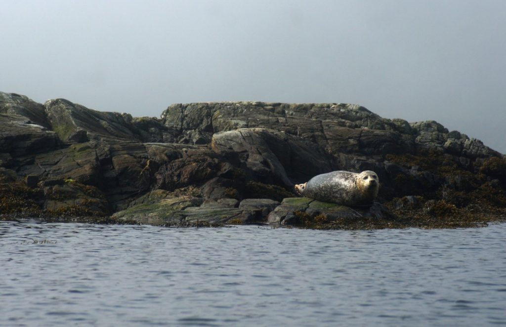
Having covered nearly 100km in the first 3 days, it was time for a slower pace for a few days. Boats loaded with overnight gear we set out from Achnahaird beach to explore the coast of Enard Bay, following the rugged coastline as far north as the Bay of Stoer. With a brisk wind blowing offshore we slowly made our way north, in and out of the countless smaller bays and between the smaller islands. Our Virgos continued to impress us, never feeling as cumbersome as some larger boats do when carrying enough chocolate spread, cheese, and biscuits to see us through. Having spent time getting up close and personal with the many seals on Soyea Island on the outward journey we took a break on islands of Fraochlan and Eilean Mor, the perfect vantage point to watch the large pod of dolphins leaping in the middle of the bay.
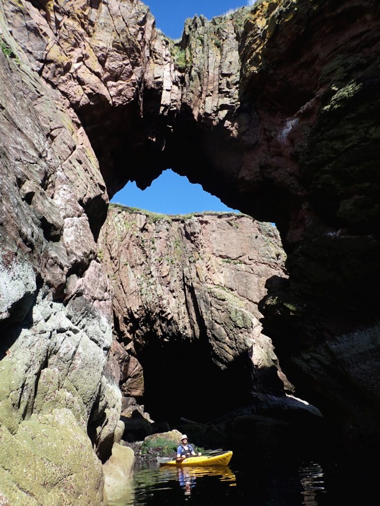
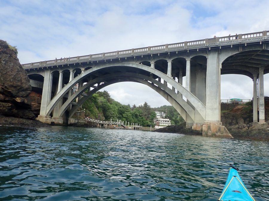
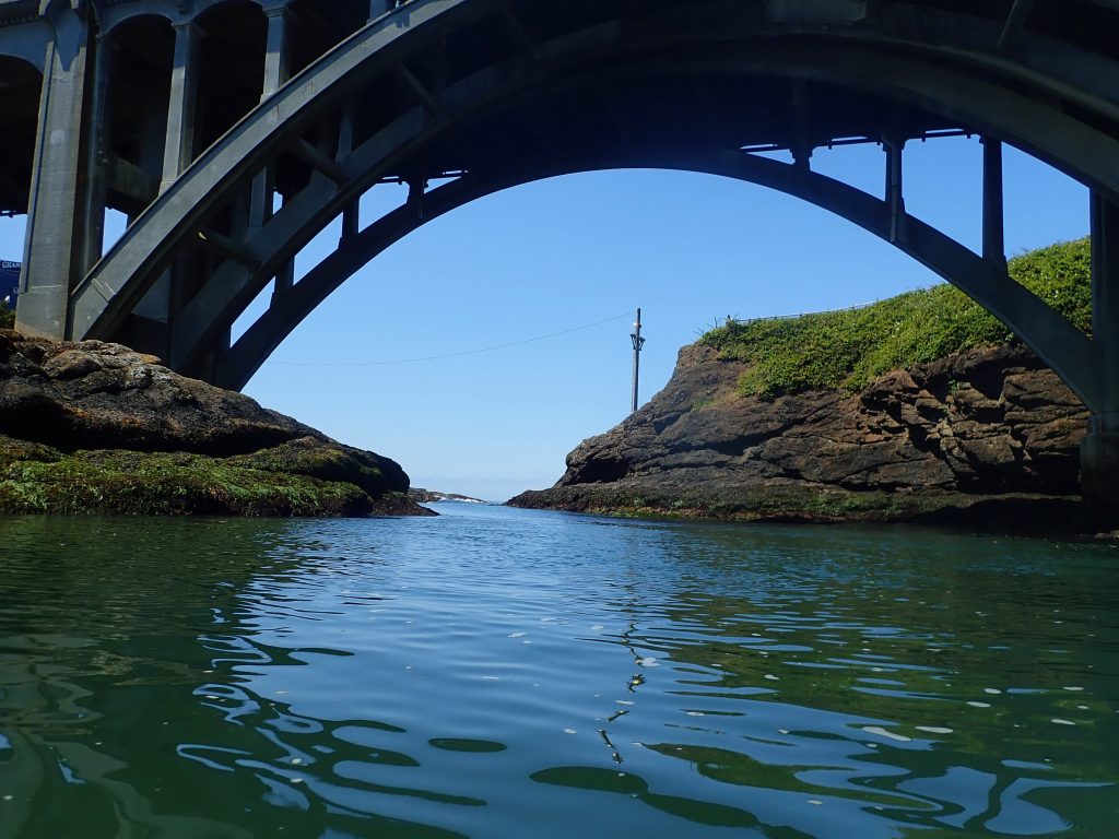
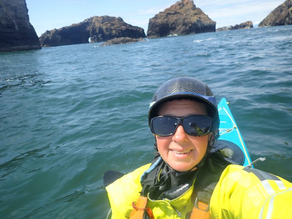
Local knowledge and advice often provides for the most memorable experiences and with Oldany Island coming highly recommended by Will Copestake of Kayak Summer Isles, it was the natural way to spend our last day in the area. Paddling out from the pristine beach at Clashnessie to the exposed outside of Oldany Island, with views back towards the Point of Stoer, we were soon rising and falling on the powerful swell with the crashing of the sea against the rocks adding a sense of exposure. As we rounded the island we again found ourselves engulfed in mist, adding to the atmosphere and creating a sense of isolation. With the disorientating mist and distraction of dozens of curious seals, we were soon lost in the maze of small islands, finding ourselves paddling into several dead ends before regaining the narrow channel separating Oldany Island from the mainland. The final few km along the coastline to Clashnessie provided plenty of interest and a magnificent archway to paddle under.
After a week of good fortune our weather window was closing and it was time for us to return home, our need for adventure sated for now, but with plans already forming for a return to explore more of this beautiful and dramatic coastline.
Day One: Loch Ewe Day Two: Southern Summer Isles Day Three: Northern Summer Isles Days Four & Five: Achnahaird to Bay of Stoer and return Day Six: Clashnessie & Oldany Island
Two weeks after I returned home from my expedition, I had jury duty. I learned that when radiologists (and other medical professionals) talk about an intake of breath, they call it an “inspiration.”
I love that!
I love that we can’t live without inspiration. I love that something we do every single day is an inspiration.
I’ve enjoyed being able to share a little bit with you about kayaking the length of the Pacific Coast of this country – from the northwest tip of Washington where I could see Canada, to San Diego Bay, where before rounding Point Loma to go into the bay I could see the Coronado Islands in Mexico.
It was breathtaking. Literally. Every day I held my breath as a whale languidly passed directly in front of my boat or a bevy of migrating birds stretching from horizon to horizon passed so close I could hear the air through their wing feathers. I involuntarily sucked in my breath when a wave collapsed on itself or broke over and around a rock. I laughed out loud when I went by Common Murre or Sea Lion rookeries with their grumbling and belching and chortling. There was the air expelled in sudden surprised tears several times, and (embarrassingly) great big loud ugly sobs when I made contact with the person who was picking me up on that day, when I was utterly exhausted and hadn’t been able to get ahold of him and thought I was going to land in a busy harbor with no place to go. There were the moments of sudden wonder that forced air out of my lungs in surprise- the moment I rounded Point Bonita and the Golden Gate Bridge came into view, the time a pod of dolphins swam out to me and split the pod on both sides of my boat, leaping into the air within just a few feet of my boat, and sank into the water, leaving my surprised breath as the only sound in the silence that filled in behind them.
“Inspiration.”
That word marked the start of the last day of my expedition. I was greeted with a video compiled from videos made by friends across the country and the world, congratulating me on completing this trip. I was given a bouquet of flowers and instructions to decorate my boat with them to remind me of all the colorful friends supporting me in this journey. I was given a white rose with those flowers in honor of Gio, a young man who went to Mexico with Chicago Adventure Therapy (CAT), the non-profit I founded and direct, and was shot and killed in Chicago 6 months later, one week before his 19th birthday. The rose was to lay on the water sometime this day, in honor and memory of Gio, and of the young people still alive, in part because of CAT. I was given a necklace. It was a silver lotus flower – a flower that grows into the sun from roots deep in muck and mud. The lotus flower was holding a piece of sea glass that had, like me, been tossed and pummeled by the sea, stripped raw and worn to the nub, to that essence where all that is left is breath and wonder.
I was greeted that morning by one last thing. A bag of flower buds. A note with them told me they “symbolize all the young people CAT has yet to inspire.” The note reminded me that “you can’t save them; you can only inspire them, as they inspire you.”
I cannot tell you that there is anyone who inspires me as much as the young people who are part of CAT. Young people who are gang-involved, non-binary, homeless, refugees, or have mental health issues or live under the poverty line, these young people have more grit and grace and courage than any other group of people I know. It is the honor of my life to get to paddle and climb and camp with these young people. I’ve cried (and sobbed) with relief, with joy, with worry, with frustration, in grief. I’ve laughed, over and over again. I’ve held my breath, expelled it involuntarily in sudden surprise. There have been moments of wonder as I watch the grace, the courage, the generosity of these young people who’ve been handed a raw deal in their lives.
I learned in October that an “inspiration” is an intake of breath. I wonder – what takes your breath away?
* * * * *
If you are inspired by CAT young people…
If you are inspired by a 1508 mile paddling trip…
If there is someone in your life who inspires you…
~ I hope you will take a moment to make a contribution to CAT.
Chicago Adventure Therapy is not closing our doors, or cancelling our summer season, because of the coronavirus epidemic. While Chicago is still under a Stay at Home Order, we are ramping up efforts to maintain connection with young people and provide referrals to concrete resources like rental assistance or food pantries that they or their families need right now. As the state re-opens, we will run modified outdoor programming where and when we believe it’s safe. Until then we’re working on engaging and relevant online materials, resources and activities to provide for young people, their families, and their communities. Your contribution will help us connect with our youth and provide respite, recreation, and relief to the fullest extent we’re able.
Just past Point Sur, far enough past and on a beach behind a rock from the lighthouse so I could avoid the park rangers, I camped on a beach that had a different look than most of the places I’d camped on this trip. It got me thinking about the trip as a whole, instead of just in the moment or the next leg. If all went well, I was just two weeks out from the end. That was hard to believe. Almost as hard to believe as the idea, two weeks into the trip, that I was going to paddle the entirety of the West Coast of this country.
It highlights one of the pretty cool things, which is that I got to watch the slow change in the land. You’d be hard-pressed to mistake this for the Washington coast! And I got to watch the change at human-powered speed.
As I watched the land and vegetation change, I also got to see the individual pieces we usually see one at a time all strung together as a whole. Instead of this beach and that headland and this other cove, I got to watch them all come together in one coastline. I got to see beaches from the outside, the outsides of headlands that mostly just fishers get to see, the shape of the whole coast.
It’s interesting too how the coast breaks into chunks. Northern Washington was cliffs and smaller sand beaches and lots of sea stacks. Southern Washington was long sandy beaches with big bays. After crossing the Columbia River, an adventure in and of itself, northern Oregon kept the long sandy beaches and bays and added stunning headlands between them. The sea stacks got fewer and bigger. Then southern Oregon was long stretches of sand dunes interrupted by bays and rivers. There’s this little stretch of far southern Oregon that I want to go back to. It’s got lots of giant sea stacks that protect all these hidden sandy coves behind dark green water.
The people I met in the different chunks were different, too. Backpackers on those small Washington beaches among the cliffs and sea stacks of Olympic National Park. A father with two young daughters who helped me carry my boat up the beach when I landed at low tide (the dad was all over Girl Power and made sure to ask questions about my trip and to let his daughters ask questions); another family who helped me carry my boat back to the water in the morning, whose son was mostly interested in searching for crabs and whose daughter was all set to climb the “mountain” at the end of the beach. An evening walk through the campground above the beach revealed identical backpacking stoves set up but put away for the night. In the bays further south I met RV campers with big campfires and beer, and sometimes big (only slightly legal) fireworks. These beaches also hosted a lot more day users – locals walking their dogs in the mornings or evenings (I met so many great dogs!), vacationers coming to the beach for the day, couples taking romantic walks… In northern Oregon, I found people horseback riding and hang gliding along the long beaches in the north. The hidden coves behind the big sea stacks in the very southern part of the state are only accessible by hiking the Oregon Coast Trail (where overnight parking is prohibited in the parking lots, so it’s all-day users) or by boat (not motorboat – it’s too close to the rocks for them!). I met a couple holed up for the day in a cave at the top of the beach, chilling out with their didjeridu.
It starts getting more arid before California – the doug firs give way to pines and then grasses, the beaches smell different, and you start to see lizards. And you realize you really have moved south. I met a man from Spain with the same name as the Cape I was at; he’d found his soul in this landscape.
In Northern California, you get stretches of sea stacks and stretches of long sandy dumpy beaches. They’re interrupted by bays – but also lagoons that you mostly don’t see because they only have an opening to the sea when the sand spits get topped. The bays have a different shape – you get the feeling they’re more like those lagoons. In California, I started periodically getting picked up by local paddlers, many of whom I’d never met before, who would take me to their homes, feed me, give me the opportunity for laundry and a shower, and give me a place to sleep for a night or two with a roof over my head. Once, friends of one of these new-found friends picked me up and provided this hospitality. He’d surfed the California coast for 50 years and gave me good beta about the rest of the coast. The generosity of the paddling community is really remarkable!
And then comes the Lost Coast with mountains straight to the water’s edge and narrow beaches at low water that aren’t there at high water. The beaches that do stay have big dumpy surf – camping is definitely a search for protected beaches. And then you find these incredible gems once you walk to the top of the beach. I saw no one (other than hikers camped where I couldn’t land) on the Lost Coast – except at Shelter Cove. It’s a busy fishing harbor. The marina, though, is at the top of a cliff on land. When fishers head in for the day, they call ahead to the marina. For a small fee, the marina sends someone down with a tractor and a boat trailer, who loads the fisher’s boat onto the trailer and hauls it up to the marina at the top of the cliff. Really and truly. I met a couple who just wanted a place on the coast where they could drink a beer and smoke a – well, we’ll call it a cigarette. They’d found it at Shelter Cove – and they spent days there on vacation drinking beer, smoking “cigarettes”, and watching the fishing boats come in and out. I met AJ, too. He’s an old Salty who grew up fishing in the area. He told me stories of heading out in an 8-foot dinghy with just a compass and a watch to navigate with. He was curious about my trip and told me about the brothers who took surfboards from Ketchikan, Alaska to Tijuana. (I crisscrossed with their story several places, starting in La Push, Washington where I stopped at a marina to inquire about a mailbox where I could mail a letter to my husband. They had stopped there to paint patterns on the bottom of their boards to ward off shark attacks)
Fort Bragg and the Mendocino coast bring rocks and inside lines again (the chance to paddle on the land side of sea stacks or rocks instead of the ocean side. The small sea stacks – or big rocks – provide enough protection that I could have paddled close enough to the cliffs to touch them with my fingertips). As you head further south the human influence gets bigger – by the Sonoma coast, there are houses above most of the coastline and kayak fishers outside the protected coves. It was along the Sonoma Coast that I shared a beach with a Catalan couple biking from Seattle to San Francisco. We had matching tents for our adventures.
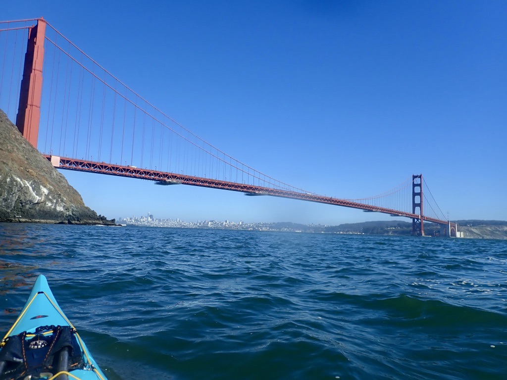
San Francisco Bay and the Golden Gate Bridge are a piece unto themselves. The juxtaposition of natural beauty and a truly beautiful piece of massive human engineering is unique. Most beautiful places are natural or human-made, not both. Just before San Francisco was the second place I paddled with anyone else. (The first place was across the Columbia River). A friend who used to live in Chicago paddled out to my campsite in Tomales Bay at night and paddled around Point Reyes with me the next day. A group of 4 people paddled with me leaving San Francisco. Unfortunately, strong south winds coupled with a flood tide that was also working against us meant that we made the decision to turn back. (The flood tide meant that as we were paddling away from the Bay, the ocean was flooding INTO the Bay – so we were paddling against the sea…) Still – company on the water and off (beers and burgers after the paddle was a great time to swap stories) was lovely.
And then you keep going, and things keep changing – and just a day out from the Bay you’re watching a notorious boomer field (a place where waves jack up over unseen rocks covered by water and can easily catch you unawares) and a long reef where Mavericks lays hidden until the right swell comes through. (Mavericks is a famous “big wave” surf spot with massive wave faces in the right conditions).
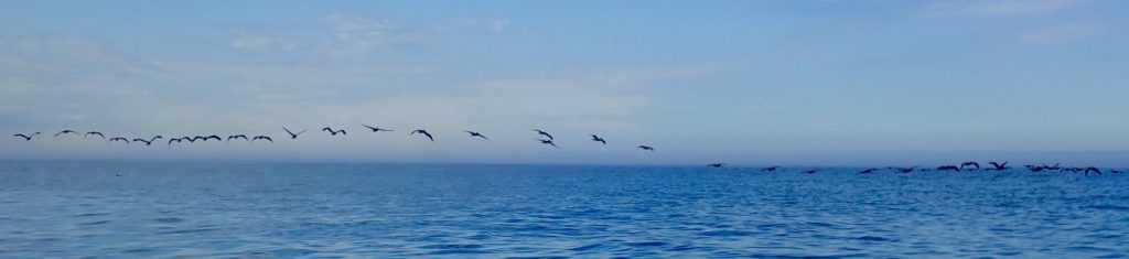
A few more days to Monterrey Bay, and then into Big Sur, where the waves against rocks felt a bit different to me – somehow more easily caught unawares. Like Mavericks, it feels like there’s a slumbering power there just under the surface. The water, when you have sunlight, is this amazing color. The cliffs come right to the water again, with very few coves that have beaches at the back. It feels similar to the Lost Coast – except there are expensive houses atop pretty much every cliff. (You don’t see them in the fog though…) The granite here made it seem like paddling next to the Rocky Mountains. I had company a couple different days after San Francisco, including crossing Monterrey Bay. In Big Sur, though, I didn’t see anyone. This is where I stopped at the place just south of Point Sur that looked so different from other places I’d camped. The next night saw one of my favorite campsites, with a freshwater lagoon and a big beach and a curious coyote in the morning. The coyote, and bugling elk at Tomales Bay, was one of the few land mammals I saw on the trip. Marine mammals, though, were amazing – whales surfacing and feeding and breaching, dolphins jumping within feet of my boat, sea lions chortling from the rocks, popping up behind me, or taking a good look at me from the front before careening away from me. And birds! I especially like pelicans. Pelicans and common murres. (They look like loons on the water – and like penguins when they fly or stand. Isn’t that just the coolest thing?) I was fascinated by egrets and herons in Big Sur – they stand on the kelp beds and fish!
And then you come out and head to Morro Bay, where it’s not far to Point Conception and Southern California. One of the more perplexing encounters I had was on the water just offshore of a nuclear power plant south of Morro Bay. I wasn’t the full mile offshore I was supposed to be – and a surfer-looking dude with wild blond hair, a metallic green wetsuit, and a lifejacket (?? OK, so that’s not so surfer-dude-looking…) on a jet ski came out to talk with me.
“You OK?”
Yep, I was good.
“Awesome, man. Just checking in.”
And he meandered off on his jet ski – towards the nuclear power plant.
The jury’s out about whether he was a low key security guard, or a dude out enjoying the water…
Anyway, I’d been told everything changes at Point Conception, which was just a couple days away now – the swell, the water temperature and color, the level of risk. And it’s Southern California – I was almost done camping. (Because how do you camp through LA and San Diego? I’d been told it was possible – but I didn’t want to try to search for hidden camping spots in the midst of huge population centers). Things did change at Point Conception – the swell was minimal, the wind was minimal (despite several days of headwinds!), the water was decidedly warmer, the weather was mostly sunny and warm, and after a (marginally legal) final beach campsite with dolphins playing in the water next to me as I landed and bioluminescence in the waves after dark, I was done camping – nights were among people in civilization. The smell of the beaches changed – mostly you can smell the pollution. But sometimes there was this surprising sweet smell that wafted from the beaches. It smelled a bit like freshwater. As in not saltwater. In the desert, a few beaches had this lush meadow smell coming off them. (I didn’t understand it).
And then there was my landing, where the sounds stand out. There’d been sounds along the way. The grumbling and chatting of common murre rookeries; the belching and snorting and yelling and mumbling of sea lions; the pop of dolphins, sea lions, or whales surfacing; the Harley Davidson sound of elephant seals on a beach too far away to be as loud as they were; the sound of an actual engine of a boat off on the horizon or fishers talking through the fog or a shipping container turning or accelerating; the myriad sounds that water makes, whether it’s the fold of a wind wave behind me, the smack or boom of a wave that seems way too small to make that sound against the cliff it just hit, the slow, inexorable rumbling and crashing of a wave coming over and around a rock; the chortling and chatting of sea lions and birds on rocks far enough away that they sound like humans singing, reminding me of Odysseus and the singing of the sirens. In Southern California, the sound of music pulsed from the beach-side bars and I started hearing traffic (I also used a traffic sign on the freeway once as an aid to navigation).
The sounds at my landing were unique. Family and friends were there to meet me. They’d told everyone on the beach what I was doing. So when I got close, the whole beach erupted in cheering and applause. There was whistling, a stranger’s assurance of a cold beer waiting for me on shore (it was actually champagne!).
And just like that, my trip was over. I’d paddled 1508 miles through a stunningly, exquisitely beautiful changing landscape. My journey through that external landscape changed my internal landscape. I don’t know the contours of this landscape yet. I hope what I will find includes a fierceness borne of the wildness of water against rock. A serenity that mirrors the calm protected waters in those inside lines behind the solid, immovable sea stacks. A joy that mimics the none-may-care, over-the-top abandon of the ridiculous and delightful sea lions chortling and belching and calling on the rocks as they go about our daily lives. I hope, at least periodically, that I can enjoy the everyday, mundane, breathtaking beauty in which we live and move and breathe – and chortle and belch – with the same reckless, absurd abandon of the sea lions.
If you’d like to read more about Dre’s West Coast Adventure, just click through to her author profile to find the full series.
A word to the wise. No one sleeps in at an active fishing harbor! The first boats put in at 4:30. The rush was over and the parking lot over-full by 7:00. The town itself, a tourist town, wouldn’t start moving until 10 or 11. I decided rather than hanging out at the harbor I’d go in search of a coffee shop to wait for the tourist shops to open. I found Whale Bites Cafe, a lovely place with chai tea and giant homemade cinnamon rolls, owned by a marine biologist who does whale-watching tours and knows most of the individual resident whales. Beth was super nice, and a couple regulars recognized me as the paddler and chatted for a while. One was a kayak fisher. Conversation with him confirmed that the kayak fishers here who go out on sit-on-top fishing kayaks are really safety-savvy. It was a great place to sit for a while with lovely people.
I got nervous about the time, though, even though it wasn’t any later than I had planned for my launch at slack with a short day ahead of me. There was just something about this leg that had me unnerved. I got my flip flops and went on my way.
Of course, a late start meant more wind. I keep forgetting that wind causes waves! It’s the only thing pretty much that causes waves at home, but here I pay attention to the swell and keep thinking of the wind just as wind. It was definitely strong enough to kick up some good waves – a solid 2 ½ to 3 feet. Not huge or unmanageable, but noticeable… It got cloudy and foggy again – everything always seems just a bit scarier when it’s cloudy. I got the forecast for the next couple days, and the swell was growing and a south wind coming in. I had planned a short day, with a really short day the next day, and a long day after that when there wasn’t much in the way of places I wanted to land. With a bigger swell and south wind coming in, I thought I should go to tomorrow’s landing spot so I could do the long day the next day before the bigger swell and south winds. Having already been nervous, I got myself psyched out again. It didn’t help when I passed my planned spot for the night, which was anything but protected with the southwest swell.
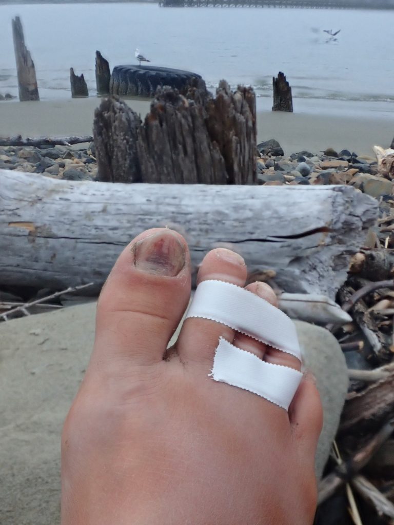
I went into Newport, and very soon came the next debacle of this leg of my journey. The beach I’d found on Google Earth looked not to have a beach at high tide. And there wasn’t much anywhere else to take out. I pulled out at the Coast Guard and hiked up to their building. I startled a young guy having some downtime in the sun by climbing up from below. He didn’t know what to tell me about where I could land, so he went and got his superior. (It turns out she’s the one who gave Freya Hoffmeister a citation for crossing the bar when it was closed!) There weren’t any good options, but they helped me find a bit of a spot to pitch my tent right on the other side of the fence from their property. (She apologized for not being able to let me stay on their property, which I thought was nice.) Anyway, it was this itty bitty loose rock beach. I took a tumble and hurt my toe. I didn’t think I’d injured it, but I changed my mind through the evening. I hobbled around setting up my tent on this itty bitty rock beach, and then hobbled to town for another restaurant meal. I was exhausted again. And my toe hurt. And the last thing I wanted to do was try to cook. I was only 2 days into this leg, and I couldn’t wait for it to be over!
Dinner was good, and the waitress was really nice. We had this amazing conversation about life, and being happy. (I think I forgot to leave a tip! When I have internet I’m going to find the place and send her her tip. There’s a special place in hell for people who don’t tip!)
I hobbled “home” and splinted my toe. I couldn’t wait for this leg to be done!
My sleeping pad sprung a leak. On this rocky beach. Uggh.
I was less than happy in the morning. I didn’t know if I’d need to leave my toe splinted, if it was dumb to go anywhere that day, if my toe was broken… I felt dumb for finding myself in this predicament and pretty exposed on this little “beach” on the channel into town. My toe felt a little bit better though, and I sure didn’t want to stay here another night, so I taped up my toe, packed my boat, and caught the ebb out of there.
I thought it would be a miserable day. It was 30 miles to a good landing spot, and it wouldn’t be the spot I’d thought because of the southwest swell. With a hurt toe and low morale.
It proved to be one of the best days so far. My toe did all right, the sun came out, and I finally found my “usual” paddling speed and cadence all day. I still psyched myself out for the small surf landing – which meant I “over-studied” it and styled the landing onto an iconic Oregon coast beach at Heceta Head.
I was planning to get up the next day (today) and paddle the last 10-12 miles to the pick up for the next mom-sponsored Airbnb and the end of this short leg. I decided instead to give my toe a break and stay here a day instead of look for a place to pitch my tent by the dive shop where my mom will pick me up tomorrow evening.
This beach may go down as one of the most beautiful, but this leg may go down as one of the worst. Or at least one of the ones I was most eager to end! Which is a little bit funny, because it’s also likely one of the ones with some of the best or most interesting memories.
Anyway – it’s a rainy day. I’m hanging out in my warm dry tent, but it’s about time to go cook some food. Here’s hoping I can end the leg on a good note tomorrow!
Post-Expedition Thoughts
When I let my mom read this post, she didn’t like it. She thought I downplayed my experience. My knowledge, the fact that I’m a good paddler with good judgment and solid skills.
Much later in the trip, an experienced expeditioner commented that I was doing it in a way that made it accessible to other people. I was really glad to hear him say that – because it’s exactly what I was trying to do.
I think one of the things that made it accessible is that I was open about the fact that it’s not easy. That the decisions are challenging. That there were times when I was scared. Really scared. That there were times I did it “OK” but didn’t do it “great.” There were times when I made some dumb mistakes.
Being scared, doing something dumb, questioning yourself – these things don’t mean you aren’t up to the task. They don’t make it a bad experience. They DO mean you need to be prepared enough to handle it when you make a mistake. Part of mitigating risk is about avoiding as many of those mistakes as possible. The other part is about having the knowledge and skill to handle it when you DO make a mistake. Because there will be something that goes wrong. If you only have the skills to handle it when you do it perfectly the first time – you don’t have the skills to handle it.
And I wanted people to know, and to see, that you don’t have to be a bad-ass hammerhead paddler to do something really big. I’m a skilled paddler. But I’m not a superstar or superhuman or a superhero.
You don’t have to be either.
You have to be good enough. “Good enough” was a high bar for this expedition. I took it very seriously to be as clear-eyed and as honest as possible with myself in determining whether I was “good enough”.
You don’t have to be perfect.
You WON’T be perfect.
So work hard to get good enough – and then have the trip of your life.
It will be scary and it will be full of mistakes and you will question yourself – and you will style it and it will be amazing.
Well – I can’t say that this trip is 100% wonderful, or that I’m doing it 100% right. I had more days off the water with my mom and her partner than I planned. I’m good with that – I think I’ll hit San Diego sometime in September.
After 3 nights in a bed and 2 days off in a motel room, Mom drove me back the 80 miles to the Salmon River south of Cascade Head. Every rest day makes me nervous again. This was a tricky landing and the beach where the river met the ocean wasn’t visible from the put in, so I was nervous.
I did just fine. Time the waves, go where they’re small. Natural river mouths with sand spits can be tricky, but I navigated this one just fine. Once I was out the surf though, the boat didn’t want to go. It also really wanted to go left. I was fighting it hard.
I didn’t understand why it was so hard. It was foggy, too, and the wind was coming from the south. The swell seemed bigger than the forecast, the surf seemed bigger than it should be, and I was nervous because it was from the southwest instead of the northwest. I was frustrated, to say the least.
About 6 miles in, I looked behind me for some reason and found the reason for the problem. The rear hatch cover was off! All the way off. It was dragging in the water (on the left – no wonder the boat wanted to go left!) The surf was landable, but I had myself psyched out. So I fixed it on the water. I can’t reach the back hatch. I hopped out of the cockpit, turned around, climbed onto the back deck, and put the cover on (I was going to pump it out, but the flooded hatch was underwater with me sitting on the back deck). I was glad I have the balance to be ON the boat. I was embarrassed I’d done this. More to the point – I was lucky this was the extent of the problems it caused.
The paddling was WAY easier now! Instead of fighting for 2.5 knots, I was going 3.5 – 4 knots. I felt like I was starting to settle into my regular paddling speed. I was 3 1/2 weeks in and was thinking I was going to be struggling the whole trip to get any speed or the type of control of the boat that I usually have.
It was an anxious day, though, and I got anxious again as I approached Depoe Bay. It’s a fascinating place with a very narrow channel into the bay between rock faces. It boasts its status as the smallest commercial harbor in the world. (I think the opening is too narrow or shallow for the Coast Guard boat at low tide.) Google Earth showed breakers outside the rocks and a swirly narrow channel that wouldn’t be visible until I was right out from the entrance. (The entrance wouldn’t be visible either).
Depoe Bay is known for its resident whales. The swell had felt bigger to me when I couldn’t get my boat to go and it was foggy. It was sunny now and my boat was moving, so I was more confident. I paddled in close to a viewpoint off the highway, wondering if I might be part of the view. A whale surfaced between me and the rocks, which was awesome! No one on land seemed to notice it – how lucky to be on the water!
The fog returned, and the swell stacked up against the rocks, and I got nervous again. My flooded back hatch meant my stern was riding really low, and the wind waves came right over the top. There were a lot of fishing boats – I was worried about visibility in the narrow channel. There were several kayak fishers – they seemed to have safety dialed in a lot better than most sit-on-top kayaks I see on the Great Lakes. I appreciated that. It also made me more nervous – they all had orange flags on the back of their boats – the flags increased visibility a lot. It made me nervous to not have one – the sport fishers would be used to seeing the flag to identify a kayak. Oy – I can really do a number on myself! The channel was perfectly visible once I was straight out from it, no fishing boats tried to run me down, the steepening waves weren’t trying to take me into the rocks. It was all good – and the channel into the harbor with the bridge over it was really quite beautiful!
When I landed, I had to deal with the swamped hatch and wet gear. I felt dumb again! I knew there was a city park at the back of the harbor. I asked around, and most of the fishermen thought no one would bug me if I set up a tent. They were right – but wow was it public! Why had I gotten myself set on stopping at Depoe Bay? I should have listened to my mom – she thought it was a bad idea because of the rocks. The rocks were fine, but if I had listened to her, I wouldn’t be camping in public next to the fish cleaning station!
I set up camp. A city employee came and asked if I planned to camp there – when I said yes, he said he didn’t see anything. He’s a paddler, so we looked at the chart together. He warned me off one of the stops I was planning, heading into a bay over a natural river opening. He used to be in the Coast Guard and said he’d pulled dead people out of that bar. I paddle the Great Lakes, where the number of people being pulled from the water is really high. The fact that people die in the water I paddle doesn’t mean I can’t paddle it safely.
I took his advice, though, and planned different landing spots.
The evening was lovely. I was more tired than expected – it was a short paddling day, about 16 miles, after several Airbnb days, but fighting the hatch cover, climbing out on the back deck, and being anxious all day left me really tired. So rather than cooking in a super public place, and maybe hanging around for the sheriff to tell me I had to move, I went into town for dinner. A nice guy at the boat launch asked about my trip and suggested a good place for dinner. Fish ‘n chips, a dram of bourbon, and an ocean view were lovely.
My next day would be a short day and slack wasn’t until 11:30, so I figured I could sleep in the next morning and go buy a couple more lighters (mine got wet) and a pair of flip flops (one of mine floated out in the hatch-cover-debacle. I loved those flip flops!)
So, I rounded Cascade Head a day early yesterday. “A day early” only means anything because my mom planned to pick me up here tomorrow for the first of three Mom-sponsored Airbnb stays this month – a bed, a shower, laundry, meals I don’t cook that I didn’t dehydrate a month ago… I suppose a purist wouldn’t approve, but I’ll take it! We got the timing wrong several months ago when Mom decided where and when to get the Airbnbs, so they’re a week behind me. Which means since I’m here a day early, Mom’s checking in and turning right around to drive 100 miles south to scoop me up. Best mom ever!!
On the ride home, Mom asked what about this has been what I expected, and what has been different. It’s a hard question because I’m not quite sure what I expected. One of the things I told her is that I’ve been surprised how often I’ve been around people. I expected a lot more isolated beaches until Southern California.
One of the side effects of that is that I’m getting to witness a slice of coastal Americana. Mostly folks on vacation, but also people who live along the coast. I’ve met Native folk and white folk who live on the reservations in northern Washington. I’ve met folk backpacking along the pacific crest trail in Olympic National Park, and people tenting and in RV parks right on the beach. I’ve met folk running campgrounds, marinas, gift shops, marina gas stations… I’ve met people who walk the various beaches every day, often with their dogs. A black lab named Willow whose the dog of a lifetime for Jean who must be in her 80s, a dog that’s ecstatic every evening when his human in Willapa Bay hits golf balls along the beach for him to chase, Tink who helps her human manage a gift shop and despite being a small dog thinks she’s a mighty adventurer when she gets to go to the beach, a big goofy dog who’s scared of the campfire but loves relaxing next to it with his humans and even more loves jumping in the hammock with both of them. I love the creative, massive construction projects the beach inspires – driftwood forts, a not-quite-water hole 4 feet by 10 feet and 3 feet deep deliberately dug just to the water level and no deeper, sandcastles and the requisite sandcastle-smashing. People walking along the beach, clamming, horseback riding, surfing, hang gliding, drinking beer, watching the beach… Folk checking out and documenting the constant erosion of the beach and folk valiantly trying to stop the erosion. People who’ve been visiting the same beach since they were children, retired folk who’ve been visiting the area since they were children but just discovered their new favorite beach and are utterly delighted with it, and folk from across the country taking their family on an epic road trip to see the Pacific. A firefighter originally from Norway who lives off the grid. A woman whose Swedish relatives outside of Portland stopped speaking German in World War Two after their Japanese neighbors were taken to internment camps, and whose church paid the taxes on their neighbors’ farms while they were in the camps so they became some of the very few who were able to come home.
I didn’t expect to encounter this cross-section of coastal life. I’ve been fascinated by it. The fascination has slowly – except rather quickly as I’m only 3 weeks in – begun to change to this funny sense of feeling so lucky to meet so many people and learn a piece of their lives and histories and stories. I feel like there’s a certain reverence these stories require.
All this was unexpected. A few people told me that the best and most memorable part of the trip would be the people I met along the way – and to stay open to that. I believed them. But I also didn’t understand how this happens. So I planned the paddling part. The expedition part. And was much more focused on what I might see than who I might meet.
I consider myself lucky to get to see the headlands and sea stacks and whales and birds and beaches and coastline that I’m paddling. To paddle these waters. And I’m so lucky to get to meet all these people along the way.
I’m lucky to get to see a slice of this country in unexpected ways.
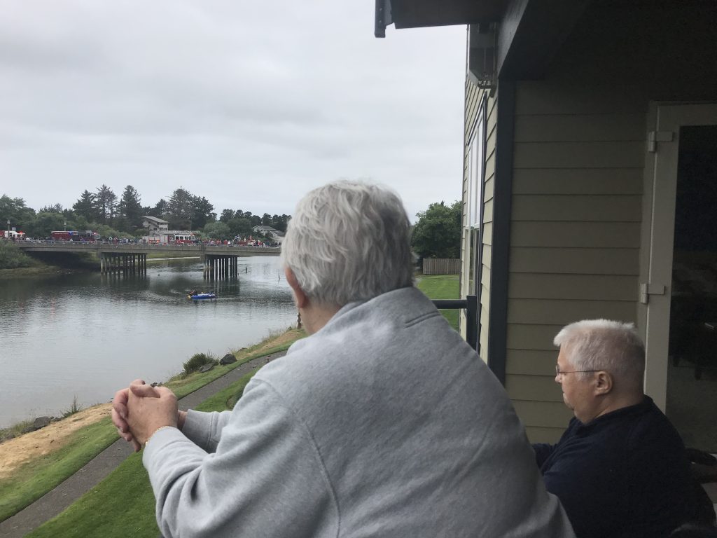
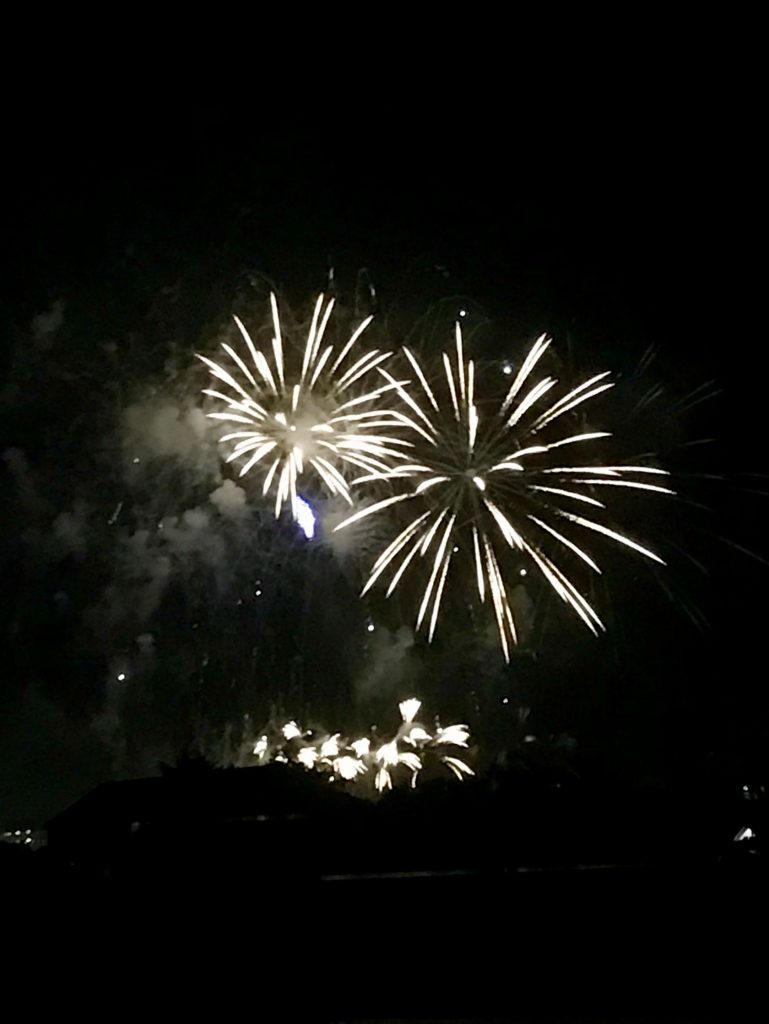
So I’m glad I rounded Cascade Head a day “early.” And that Mom came to pick me up a day early. And that I got to spend 4th of July with family, soaking in a small town parade (and the young folk who watched from kayaks) and watching fireworks from the balcony. It’s the epitome of Americana.
Post-Expedition Thoughts
July 4 became sort of a touchstone for me. The people I met along the way became such a big part of this expedition. I’d been told to stay open to that, to make room for it. My mom’s question, during small town July 4 celebrations, helped me to see how it was happening.
This was gruelling paddling. I was spending an hour paddling in 5-minute intervals. Literally – I’d paddle, think I was at 5 minutes, look at my watch, and it had been 2 minutes. Another 3 sounded impossible. Finish the 5 minutes, and do it again 10 more times. I think of intervals as being a training technique to build endurance. These intervals were about breaking it down in order to make this possible.
Waiting with the guys at Willapa Bay
I’d been pretty proud of myself. I’d holed up in Willapa Bay for several days waiting for the right day to cross the Columbia River – the right tides, low swell, low wind. The forecast had held for several days, and this was the day to paddle to where I’d be one day out. I got up early in order to catch high water. Crossing the mouth of the bay are a lot of sanders that create big breakers when the water is low. I hit the tide just right and crossed with very little wave action, which meant I didn’t have to go way out and around. I was feeling good about my timing, my judgment, my prediction of what would work…
As I approached Lead enter Point, my progress seemed slow. Was I getting pushed out by the ebbing tide?
Sunset at Willapa Bay
Another hour in, I was only making 3 knots average travelling speed. My usual is 4, and I’d been averaging 3 and a half on this trip. Then the paddling started to get hard. By 11:00, it was really hard. I was paddling full force and barely making 3 knots.
I realized I was paddling 20 miles towards the Columbia, and the tide was ebbing. This is a big river. When it ebbs, it doesn’t just push out into the ocean, it pushes out to the sides up and down the coast. I was fighting the full force of the Columbia River.
Landing at the south jetty (can you spot me?!)
At 11:00, with high water at about 7:00 am, it should be letting up a little. Except the river ebbs a lot more than it floods, so the max ebb might well be in another hour. At noon, I paddled my hardest, took a break to look at my watch, and it had been 5 minutes. And my hour of 5-minute intervals began.
So this is how it was going to be. The day before, waiting on the right tides for crossing the river, I had realized I needed to get OK with being where I am. Not where I want to be instead, but where I am. It was easier the day before. Right now it was about one stroke after the next.
The day before was a bit more Zen. I was waiting on neaps (good tides, with the least amount of water going in and out), good swell (smaller waves, with less time between them), good wind (as little as possible). I was prepping for my early launch the next day, and I was antsy. I hadn’t wanted to wait the several days I did. I was anxious and impatient and not enjoying the beach or the view that a bunch of people had come to over the weekend for their vacation. Here I was in the middle of it, not enjoying it. And I thought – “be where you are.” I was here, and I could fuss about waiting or about prepping for where I wasn’t yet, or I could stop. I could enjoy the beach, the sunset (it was the best sunset of the trip so far), my dinner, the evening. I met Ed and Gayle, who had a home close by and were checking out the changes in the beach (this beach is eroding fast – over 40 homes have washed away in the last decade). They were a lovely couple, very pleasant to talk to.
Be where you are. It was all good.
Today, “Be where you are” meant “I would really like to be done.” I under-estimated the distance, me, the difficulty. My mom picked me up off the beach – she got a motel room for my last night in Washington to have a good place to land today and to launch to cross the Columbia. She picked me up about 5 miles north of where we planned, and we scouted out a place to launch the next day a few miles south of where we planned.
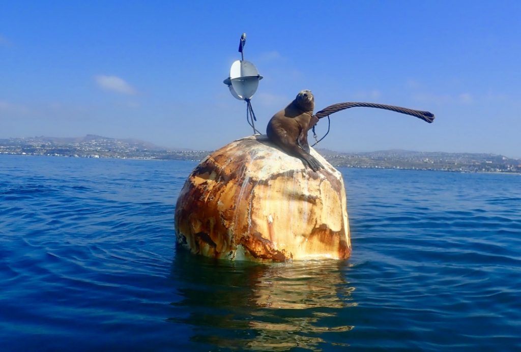
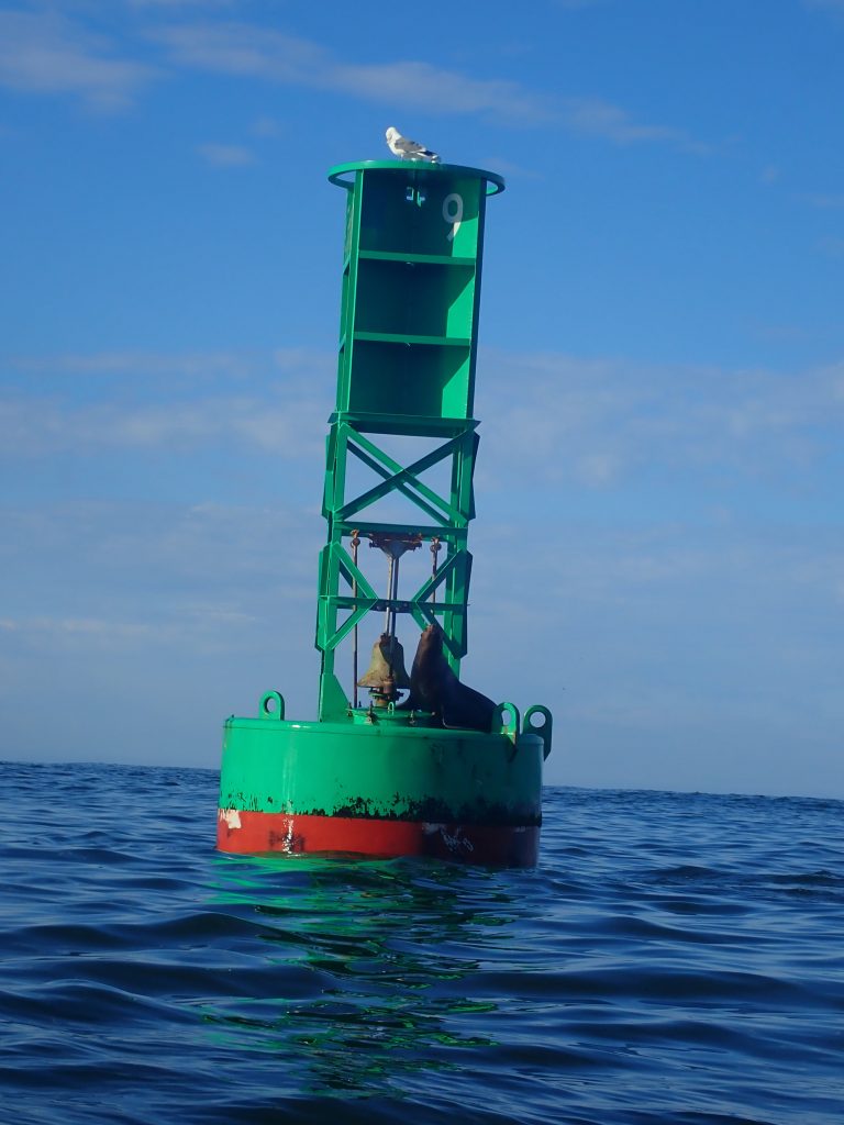
Columbia River buoy
— I do not regret not paddling that 6-8 miles of coastland! —
Be where you are. Waiting in Willapa Bay, fighting the ebb, a 4 am wake-up the next day. All of this got me on the Columbia River at the end of the flood with no wind and low swell. It was glassy calm, stunning, incredible. “Be where you are.” Because this is gorgeous. This is unique. This is worth paying attention to.
This is worth being in those other places, waiting and pushing and wondering why in the world I was doing this.
Post-Expedition Thoughts
“Be where you are.” Few of us are where we want to be right now. And we are decidedly where we are.
It’s a bit too “easy”, too trite, to say “be where you are”. Be OK with it. Because this is hard. It’s not a place anyone should feel fully good about being.
Still – I expect that on our better “Corona Days”, there’s something to be learned. Or re-learned. Because we can’t make this go away. We can’t not be here.
If it’s one of your “not better” Corona Days, I hope the stories or photos of my Columbia River exploits help a little bit.
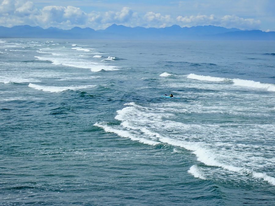
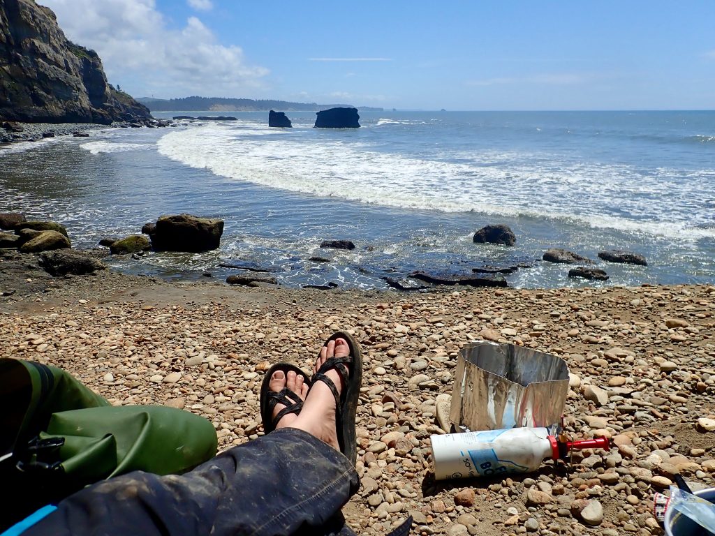
I’m sitting in the sun above a secluded cove eating brunch, watching seals and the tide come in, finishing a lazy brunch of eggs, refried beans, and a mug of tea. You can’t drive to this cafe. You can’t even hike. I paddled 39 miles yesterday to get here.
The forecast was 4-foot swell, with the period steadily dropping from 12 seconds several days ago. On yesterday’s paddle, though, it seemed higher and longer. I suspected a longer period swell was coming in – there were larger sets coming through all day, breaking further out than the rest and looking scarier than the predicted 4 feet at a diminishing period.
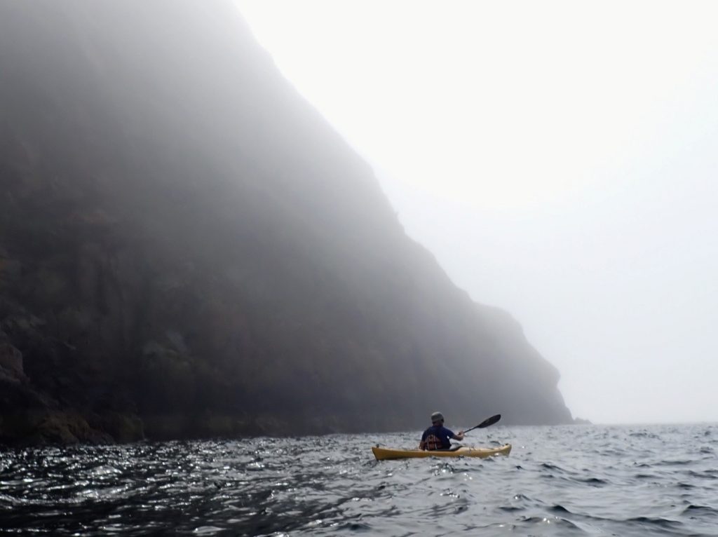
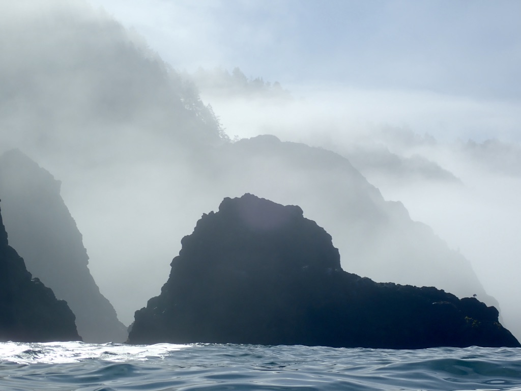
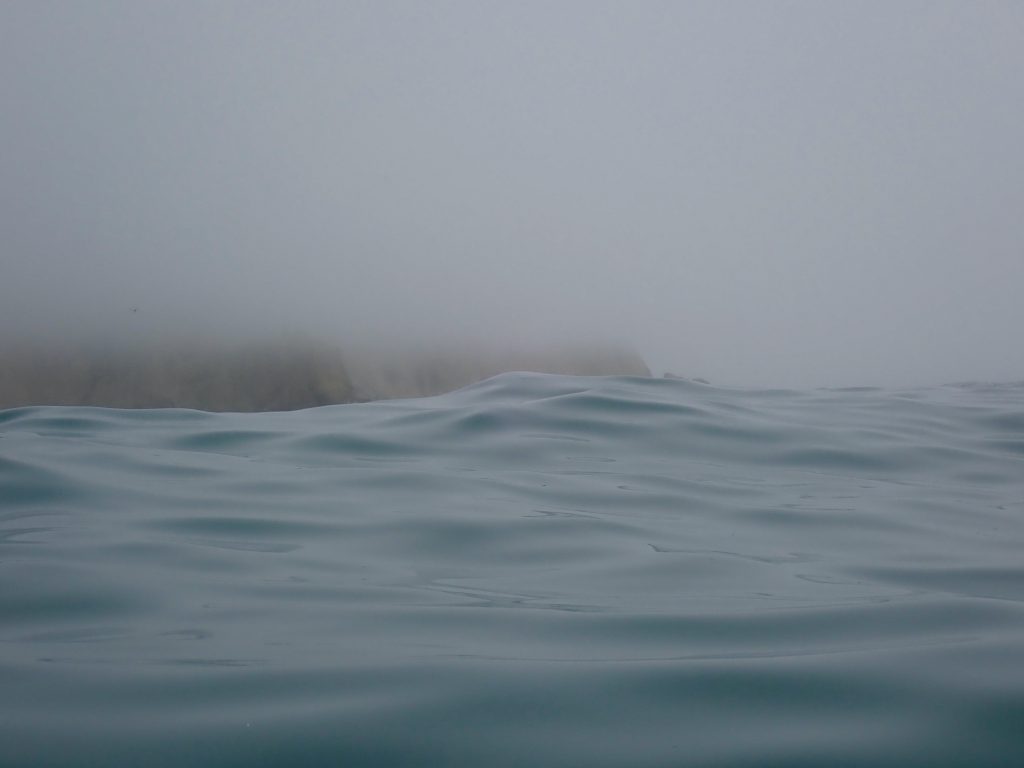
Fog rolled in around 6 to 7 miles from the beach I was looking for, one of the few protected beaches in 30 miles either direction. It got REALLY foggy about 3 miles from my goal. I could just make out those same big sets, that seemed bigger (I don’t know if they were or if it was the fog…), breaking into cliffs. I couldn’t see where I was going – just the shore I needed to stay away from.
Lost people go in circles. Trusting my compass to keep me padding along the shore instead of heading in made me feel like I was going in circles. I had to keep turning out from the shore to go out past the steepening swell. I had to trust my compass and my chart. Looking at the chart, I estimated I was about 45 minutes away from the bay where shore would get further away and I would need to go in behind rocks to find my protected beach. I was already terrified, and now more terrified. How would I navigate the rocks? There was big swell coming around them and breaking, and I wasn’t sure if there was a safe line through. I opted to go out and around. Which got me through the rocks, and turned around in the fog. I couldn’t see my shore, but I could see the rocks, and the chart showed me the direction of the line of rocks and my direction from shore. I was in behind the rocks and needed to head north to my beach.
I was terrified.
I was looking at what seemed unbroken cliffs with the big swell breaking onto them. But I saw an arch that was clearly Grenville Arch. There was a safe way in a bit closer to where my protected beach SHOULD be. And then I realized I was sitting in protected water, and the surf on this beach was much smaller. It was safely landable.
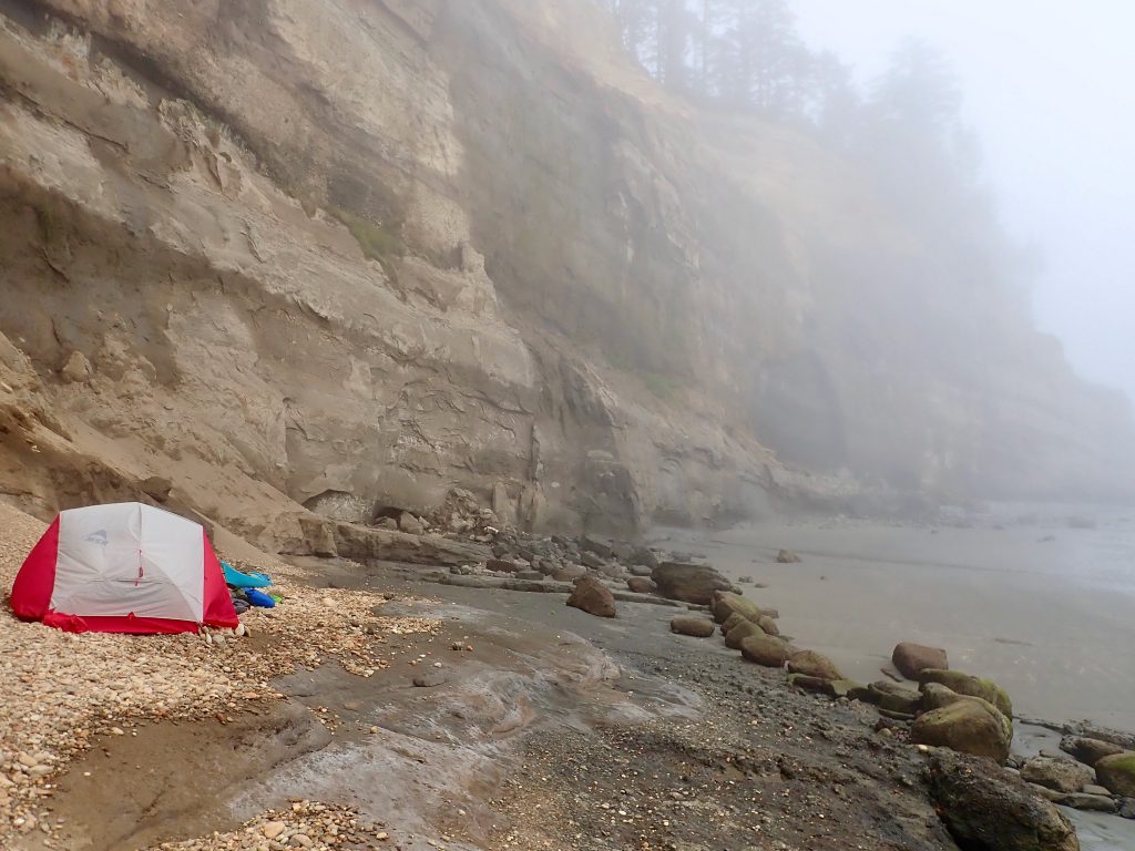
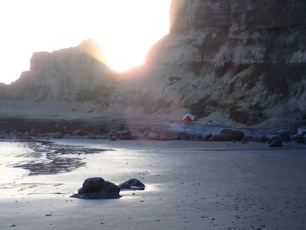
The beach disappears at high tide, so I had to make a level shelf on a ledge above the beach, with a little shelf to hold it so I wouldn’t slide, and a little “patio” so I wouldn’t slide off the cliff when I got up to pee at night. I was exhausted and still a little scared and I had massive blisters – this was all hard work.
The water came really close to my tent that night. I was up 40 minutes both sides of high tide. I got splashed 4 times and had my stuff in bags in case I needed to climb the cliff…
I was feeling a ton of stress, exhaustion and pain just 5 paddling days into my 4-month-long journey.
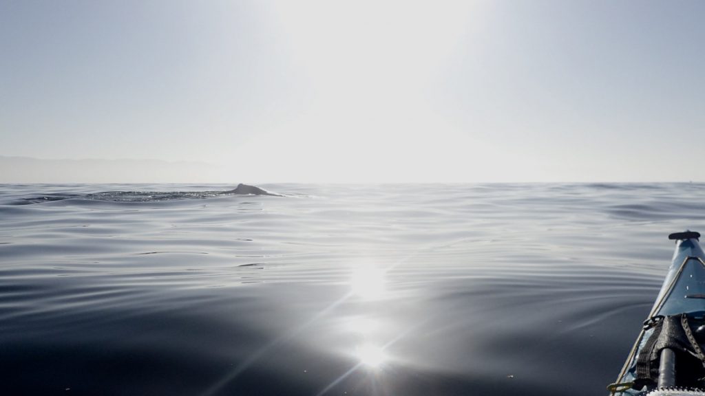
But before the fog settled in, there was a whale. Right beside me. It surfaced 3 times, all slow like a whale does, making its ‘pffffsssshhhh’ sound, barnacles on its back. And here I am, finishing brunch in the sun, watching the sea. And I’m so lucky I get to be here, to do this, to see this beach.
Post-Expedition Thoughts
This day was one of firsts that became commonplace. My first 30+ mile day. My first whale. My first thick fog with rocks. My first time being scared. My first hard-to-locate landing. What stands out most about it several months later isn’t the fear of the swell against rocks in fog, or the dis-orientation of having to follow my compass when it felt subjectively like I had paddled in a full circle instead of a straight line along the coast, or the wonder of a whale close at hand. What stands out months later is the beach. It remains one of my favorite beaches of the whole expedition. The day ends up lodged in my memory as a good one. Which is kind of cool.