A review of the Aries after a years coaching and playing with Olly Sanders.
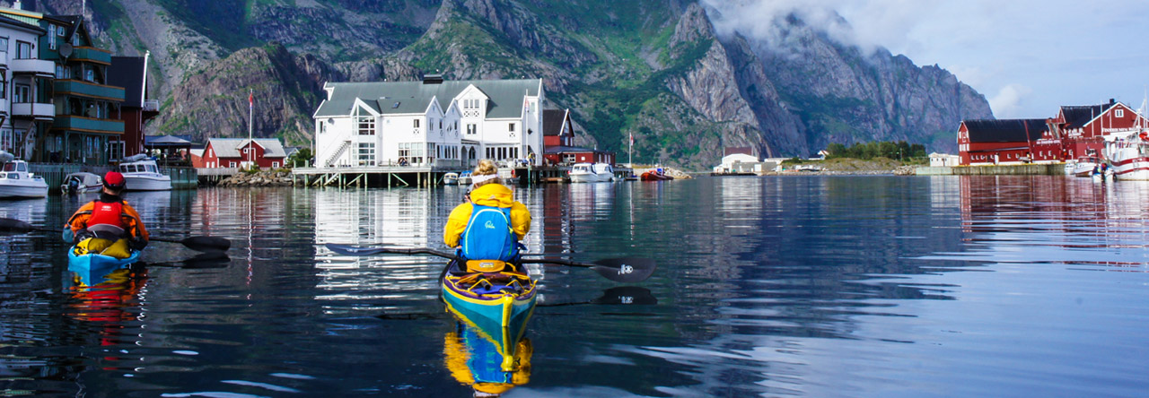
The sun shone as paddlers descended on the Braid country park in the Northumberland town of Amble. The race is a five mile route down the river, out through the harbour and round Coquet Island.

Here paddlers are assembling before the start. I’m the one in the dark boat in the far background. Conditions are about perfect and the seals and terns are ready and waiting to ambush us in the vicinity of the island.
This is where we went.


I couldn’t take pictures during the event, but this is the prizegiving afterwards. I won the women’s prize paddling my lovely lightweight carbon kevlar Cetus LV but I think I’m going to have to do a bit more training before next time as there wasn’t much gap between first and second.
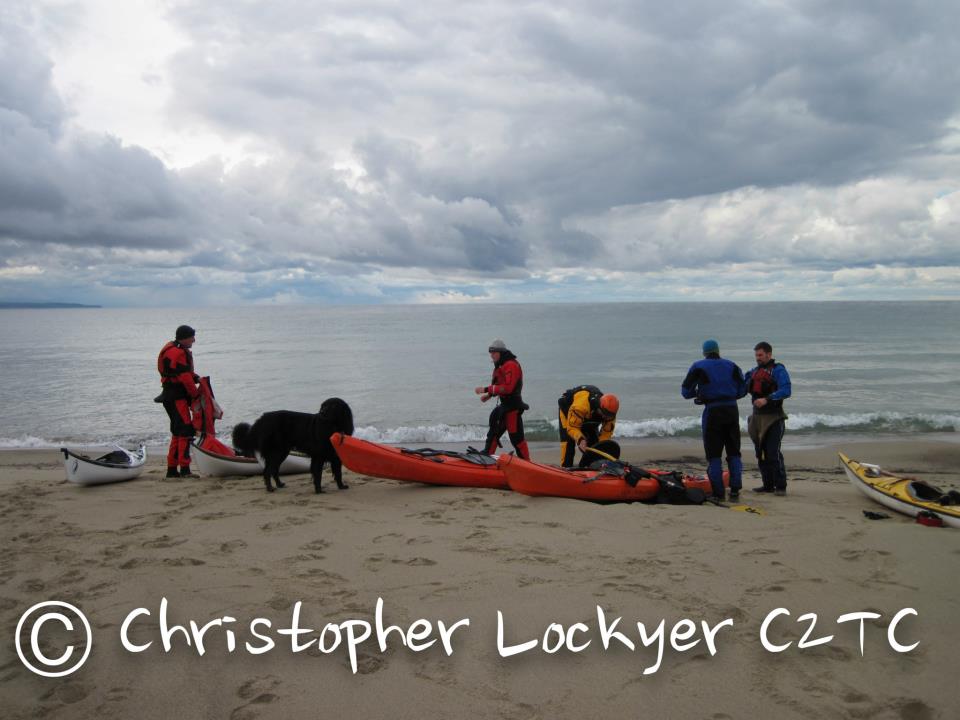
Last weekend saw around 250 paddlers descend on the Sleat peninsula of Skye for the Scottish Sea Kayak Symposium. The weather was kind to us and it was good to see so many folks enjoying the sunshine, the coaching, guided trips and just general banter.
The first session I attended was on forward paddling technique.

Next was a session all about balance. Gordon Brown led us in a range of crazy stunts that had us soaking wet, but by the end of the session, very much more balanced in our boats. Here I am proving how stable a Cetus LV is.

And here’s Kevin trying out a Cetus HV.

And here’s me again, paddling SOT style.

Greenland rolling was a popular session with many people wanting to explore traditional skills.

This was a session on self rescues.

More rolling practice.

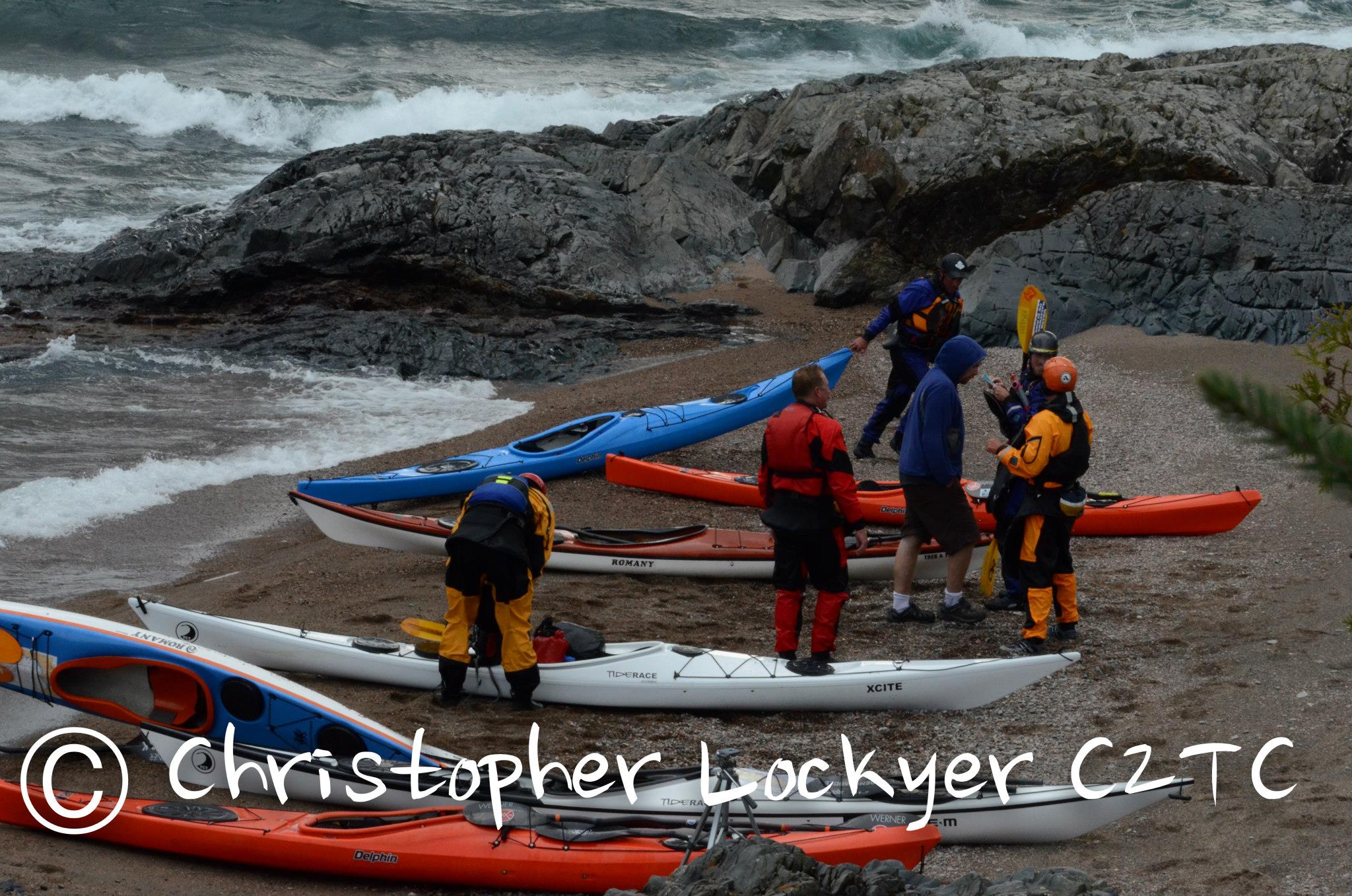
After the main event, there were four days of guided journeys. Rowland and I led this group on an otter spotting journey from Kyleakin towards Plockton and back. Sadly we didn’t see any otters but had fantastic views across to the distant Cuillin.

Found an adder lurking in the grass of an abandonned village.

Always a magic moment when an otter sits still long enough to take a photo.

On Thursday, Rob and I led a group on a journey from Elgol into Coruisk and then round the island of Soay before returning to Elgol. The scenary was stunning and the weather couldn’t have been better.

This was a great chance to put my new Cetus LV through its paces and I’m pleased to say it paddles just as well as it looks.

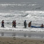
Last week I had the opportunity to paddle around Cumberland Island off Georgia’s Southernmost coast. Cumberland is an Island with lots of history and a pretty diverse set of scenery to accompany it including salt marshes, giant sand dunes, wild horses, old mansion ruins and beautiful Live Oak and Saw Palmetto Maritime forests. I checked with a few Guided trips in the week long range and altered those to make for a 3 night trip. I decided to leave from Crooked River State Park. The planned day of departure there were Tornado Warnings and 12-14′ surf so I spent an extra day getting acquainted with St. Mary’s and took a trip over to the neighboring Jacksonville to grab some last minute items from REI and Black Creek Outfitters. The next morning I took off with the tide from the Crooked River launch site. First night was the Brickhill Bluff campsite on the Northwest side of the Island. Following sand bars and salt marshes the whole way out in protected waters I was able to see numerous small sharks along the shoals and a dolphin or two.

The campsite at Brickhill Bluff offered multiple spots with great views under huge Live Oak trees with plenty of flat ground to set up your campsite at all spots. There were obvious signs of horses being in this area so I didn’t want to set up in a possible horse path. I’m glad since I was awoken in the night to three horses casually eating the grass behind my tent. I was able to hike around some of the trails in that area before cooking dinner and heading in for the night. I was anxious to see what the North side of the Island would look like the next day as that would be the beginning of the harder part of the day. The plan was to ride out the tide and that I did doing 7 miles in a hour before hitting the Pelican Banks round the Northernmost side of the Island. The tide was low enough that I had to go about 3/4 of a mile off shore and the Southwest wind was really starting to pick up and I felt it quite a bit out there.


Around the shoals I could see ominous skies matching the brutal wind kicked up in my face. This went on for another 15 miles building from 15-20 knts head on with little to no let up whatsoever. I made 2 stops to check my National Park Map to my chart to try and figure best where my campsite actually was. Huge dunes lined the Northern tip and stretched the entire 17.5 mile Atlantic coast aside from the inlet at Christmas Creek which was another haul way out off shore to get around the ever present shoals. Most of the Atlantic was smaller 2-3′ foot swell due to the offshore wind but Stafford Shoals was kicked up a bit, at least I knew the Stafford campsite could not be more than a mile away. When I finally reached the Stafford pull out, poorly marked with only a 6 foot black and white post) I walked up to the Dunes to find the inside flooded from all the previous days storms. I decided, even though not technically legal, considering I had not seen more than 1 other person the whole day to just set up camp on the beach. The site turned out to be spectacular and I had no visitors aside form one interesting hiker that gave my only conversation for the day.


The next morning I awoke to a beautiful sunrise and no wind! I made some coffee and hit the water leisurely with Sea Camp set as my destination, around the South side of the Island and in a bit. I reached the North Jetty of the entrance to Cumberland Sound which sticks out 2.5 miles into the ocean and decided to surf in to the beach to consult the chart. The tide was rushing out for another 4 hours and submarines are found to produce crazy wakes near the mouth of the Pass so I decided to portage the boat around the jetty. Adding 5 miles of questionable paddling did not seem like the best option. I pulled around to a nice sandy beach with a shady spot under some trees to relax after and easy morning but hard day the previous day. I was in no rush and was also waiting for the tide to turn around. 6 wild horses stepped out from the woods and trotted casually down the beach next to me as I watched the coast guard running drills in front of Fort Clinch in their Defenders and MLB’s. Around slack tide I took off again towards Sea Camp and had a low key paddle in to the dock. Again I had a long portage to get the boat over to the bluff where there was a path up and then about a 10′ hike up the berm. I unloaded into the carts they have there and hiked the almost mile into camp.


The next morning I spent hiking to see the Dungeness Mansion Ruins site which has Thomas Carnegie’s old estate among many other ruins and buildings from 100 years back. Horses roamed the grass fields here as wild turkey grazed as well. I was again in no hurry as I was waiting for the tide to turn again. After noon I hiked back to camp and got ready for departure around slack again. Reversed the portage of the day before and then headed off with the tide back to Crooked River for what turned out to be one of my favorite trips so far!


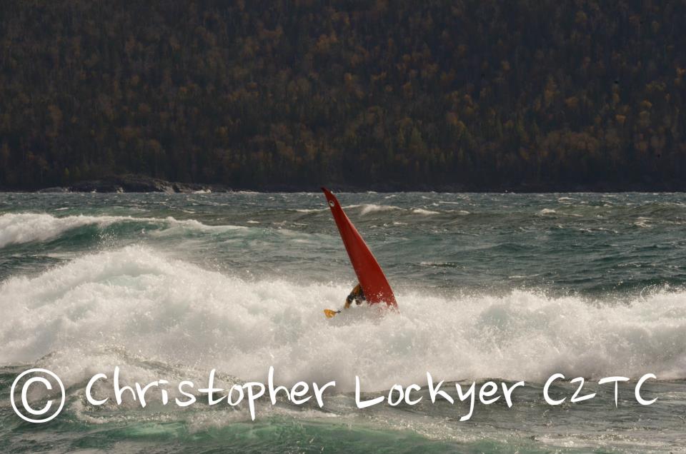
The surf rolled in, with a 10 second interval, gentle offshore breeze and all under a beautiful sunny day. Perfect. What further made this a perfect day was that it was the middle of February at Rhosneigr, Anglesey, North Wales. That day seems something of the distant past now, of another coast and land, as snow and Baltic type temperatures grip our coast. So lets return there just for a moment!
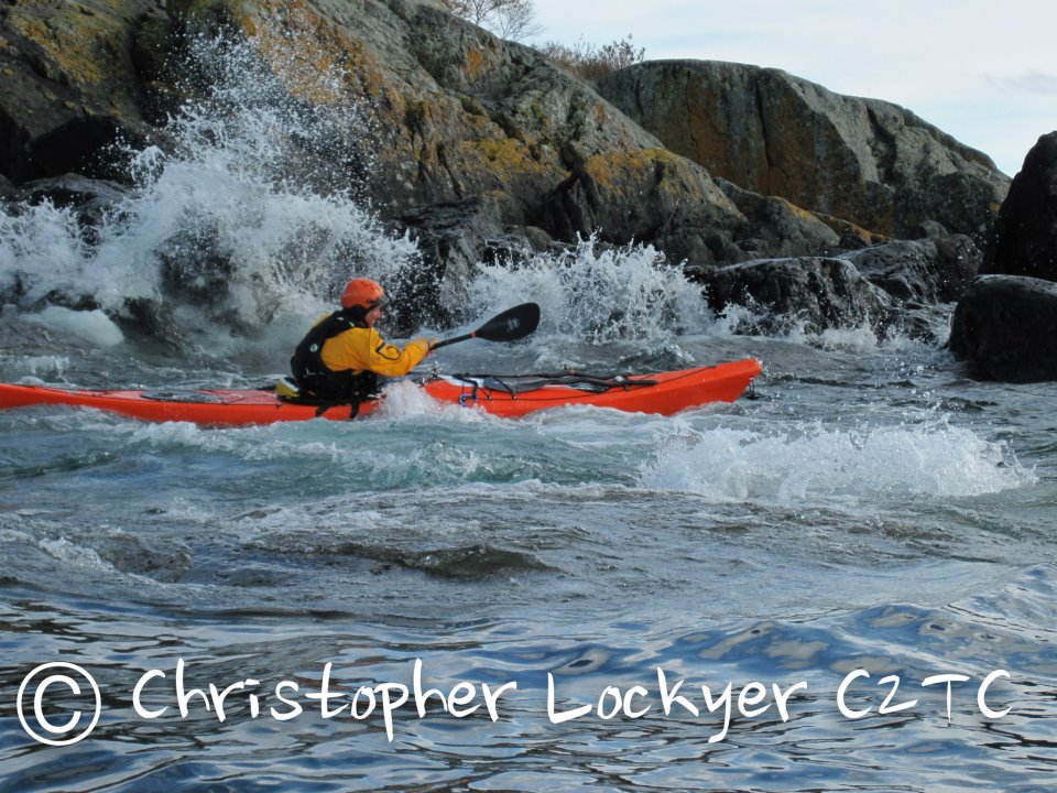
I’d briefly paddled the Aries before and was keen to spend longer paddling one and seeing what I could do in it. But I needed to get my hand’s on one. Olly Saunder’s was away and he had an Aries, um maybe….? With a quick text and a detour I had the loan of one, fantastic!
After 5 hours of surfing what clearly stands out for me with the Aries is that it is very forgiving. This then has a knock on effect of building confidence. Not once did I feel thrown by the kayak. Yes, I rolled a couple of times but this was more down to me, rather than the kayak, putting me in. I felt I could trust the Aries and this allowed me to take bigger waves or more committing moves. Being able to trust the Aires allowed me to experiment with moves. I could hold an edge and turn with very little effort. As I started to experiment more with body trim, pressure, dropping a shoulder and weight transfer to turn the Aries, the kayak responded dynamically. It was solid, yet responsive and was also a lot of fun.


The only problem I had, was at the end of the day I had to give it back!
Roger
roger chandler
www.coastalspirit.com
Photos taken by Barry Shaw and thanks to Olly for the loan of the Aries!

Photo: Bill Vonnegut Paddler: Bryant Burkhardt
The Golden Gate Sea Kayak Symposium organized by Matt Palmariello and Sean Morley continues to be one of my absolute favorite events to attend. It, along with other recent rough water instructional based symposiums, are continuing to grow and shape the sport in exciting ways. The students and coaches these events draw always make for a high energy and enthusiastic atmosphere that is intoxicating and contagious as hell. Safety and FUN is the name of the game and it shows. What a BLAST!
Distance: 3780 miles / 6083 kilometres
Duration: 117 days (11.06.2012 – 05.10.2012)
Kayak: P & H Scorpio 170
The 7 rivers 7 continents project is a multi-year undertaking to make paddling descents of the longest river on each continent. 22 000 miles in total.
Amazon River(South America) – 6937 km (4300 miles) – completed 2007/2008
Missouri- Mississippi River (North America) – 6083 km (3780 miles) – completed 2012
Nile River(Africa) – 6650 km (4132 miles)
Yangtze River(Asia) – 6300 km (3916 miles)
Volga River(Europe) – 3645 km (2266 miles)
Murray-Darling River(Australia) – 3370 km (2904 miles)
Onyx River(Antarctica) – 40 km (25 miles)
My descent of North America’s longest river system, the Missouri-Mississippi River took 117 days paddling 3780 miles across the USA. The descent began at the river’s utmost source, Brower’s Spring in Montana’s Centennial Mountains. The spring lies at an altitude of approximately 2680m above sea level. In early June when I began my descent the spring was still covered by at least 1.5 metres of snow.
On the 11th June I set off from my established base camp amongst the dense pine trees towards the spring. I followed the upper most waterway known as Hell Roaring Creek; a steep narrow creek as closely as possible. After 5 hours of ascent I was forced on to snow shoes. In my hand I carried bear spray and called out to bears till my voice became hoarse. Finally, following 7 hours of hard uphill slog I reached the spring. Waypoint marked, images recorded, my descent could begin.

For several hours, Hell Roaring Creek alternately ran free and was covered by old snow and ice. At this time, impossible to run. Too much snow and not enough water. After another 5 hours of descent I stumbled exhausted into my camp, day 1 over.

Hell Roaring Creek runs out of steep sided canyon into a wide, flat valley floor. Still too shallow to kayak I would follow the creek for 22 miles on foot as it flowed into Upper and Lower Red Rock Lakes, closed at this time of year to paddling in order to protect nesting birds. Still with bear spray in hand, moose, deer, eagles and other birds were to be found.
As I passed the wildlife refuge office I arranged with the manager, Bill West to transport my kayak from my camp to the outlet of the lower lake. Bill was happy to do so and in his pickup we explored the refuge on the way to collect the boat. Bill dropped my kayak off and deposited me back at the office in order that I might not break my human-powered journey. With the sun setting I marched out the final 4 miles to my boat. Bill had told me to keep an eye out for a wolf pack in the area. Sure enough at dinner that evening they showed up, with little fear of my headlamp and yelling. Bigger and much more bold than coyotes they watched a while before disappearing into the night.

At dawn the next day I packed my kayak and slid into the water. Finally I was paddling. The Red Rock River flowed slowly and meandered like a lazy snake. Sometimes deep enough, though often I dragged my boat across a rocky bottom. The small river flowed into Lima Reservoir, which I crossed in a morning without a breath of wind. My first portage around the dam was short and sharp. Putting back on the water, the river now flowed much more quickly. Sieves and strainers littered the banks and bends.
Piloting a near 17 foot boat round a sharp bend on a 18 foot wide fast flowing river takes some doing. It was an intense beginning to a 4000 mile journey, but the Scorpio handled it all with ease. I pulled hard on my paddle, utilising every stroke in my arsenal.
Soon enough, trees in the river became secondary obstacles. Ranchers had begun to place fences across the narrow river. At first, a few strands of wire appeared. Sometimes I could duck underneath. Other times it meant a quick exit, pushing the kayak beneath the lowest strand and submerging myself completely into the icy water. Frustrating but all part of the journey. Next, strands of electric fence criss crossed my path. Were they live? I had no plans to find out and avoided them as best I could. Barbed wire fences were next. Exiting a fast corner to see clusters of sharp wire blocking my way necessitated some pretty quick thinking. Here and there I got caught up on the strands but managed to escape the worst. The final fence variation was a hybrid of barbed wire and roofing iron completely blocking my path. It was often a case of “WTF?”, but with no one around to complain to I simply pushed on.
The near 300 miles from Brower’s Spring to Three Forks took a little under a fortnight. It was both a beautiful and isolated descent, as well as being frustrating and mundane in it’s sameness. For days on end the river sat a metre or so below the river bank, short grass and an occasional cow poking it’s nose over the edge.
Below Clark Canyon Reservoir the river became the Beaverhead. Now, less isolated and suddenly busy. Not with paddlers but fly fisherman in drift boats. So common, sitting in deep pockets of river, it was an ordeal just keeping out of their way. Sometimes a wave from an old timer but mostly their eyes never left the quivering end of their fishing poles.
Beyond the town of Twin Bridges the Beaverhead meets the Big Hole River to form the Jefferson. My spirits soared on this stretch of waterway. Clear, fast and wide it flowed. Fields of green grass, colourful flowers and groves of cottonwoods lined the banks. This is paddling I thought.

All too quickly the Jefferson led me to Three Forks. Here it meets with the rivers, Gallatin and Madison to form the Missouri River proper. Already the muddy brown colour it will keep on it’s long meander to the ocean, the Missouri grew wide and flowed at a rapid clip.

The dammed upper covers almost 1500 miles and is pocked with a dozen lakes and dams. Free flowing here and there but for the most part a slow haul across bodies of water ranging from a few miles long to more than 200.
Easily the most challenging are the “Big 3”. Fort Peck Lake stretching more than 130 miles in length, it’s shores dry and bleak cover a greater distance the the entire coast of California. Little or no sign of man to be found. Multiple 3-5 mile open water crossings to be made on a lake where the wind can go from still to gale force in 30 seconds.
Lake Sakakawea, more than 150 miles long and 10 miles at it’s widest point. Less isolated than Peck it’s shores are more uniform and easier to follow. Entering from it’s western end is a game of guesswork. A muddy delta with multiple braids blocks access to open water for many miles. Maps are useless in this ever changing environment. Instinct combined with trial and error led me to the lake proper.
Finally, the 230 mile long Lake Oahe appears. Between 1 and 4 miles wide the lake has a reputation for being the most difficult to traverse on the entire river. Being windbound for 4 days or more is not uncommon. I made the crossing in 8.5 days, losing just a day and a half to wind.

Of the 16 lakes and dams I traversed I paddled every lake and manually portaged every dam. Sometimes this portage was a few hundred metres but often a couple of miles or more. Loading my kayak onto the cart I hauled it up and over steep tracks and cross country to search for an appropriate put-in below the huge concrete expanse holding up the river.

Gavins Point Dam, South Dakota sits just a few miles above the town of Yankton. Here, my journey reached a significant milestone. Below the dam, the Missouri would finally, after more than 1800 miles, run free till it’s waters reached the Gulf of Mexico.
My mind conjured up easy days paddling, the swift current aiding me along. The first day out of Yankton into a stiff headwind and driving rain brought me to my senses. Even though I was back to reality I was unswayed in my paddle to the ocean.
Days in my kayak were long. I tried to be on the water at 7am and would paddle till 7pm, never leaving the water. My alarm would sound like a jackhammer to my ears at 05:30 hrs every morning. Dragging myself from my warm sleeping bag I would conjure up coffee and instant oats. The task of breaking camp was smooth after a couple of months on river. Rather than stop for the toilet I carried a pee bottle and instead of pulling ashore for lunch I would chow down on chocolate bars, oat bars, trail mix and beef jerky throughout the day. As the sun began to set the search for a campsite would begin. This year, in a complete reversal to last the Missouri River is at low water. Many of the states through which it flows are in severe drought. The benefit this brought me was a plentiful supply of exposed sand bars on which to spend the night. Having found high ground, I would set up my tent and gather wood for a fire. Dinner comprised of packet rice and pouches of tuna or sardines. A fifth of the cost of dehydrated meals, just as light, if not quite as nutritious.
On a good long day of paddling between Yankton and St. Louis (where the Missouri meets the Mississippi) I could cover more than 70 miles. My cadence became so rhythmic that I could time my arrival at mile markers to less than a couple of minutes over an entire day. Some feat!

The 700 odd miles I paddled to St. Louis passed by in a couple of weeks. Long days on the water, perfect isolated campsites punctuated by the odd muddy one or stealth camping in an urban park. I would stop in towns whose waterfronts were accessible to me but avoided major centres like Omaha and Kansas City. No place to leave a kayak and gear alone and expect it to be there on your return. In small towns I would resupply with food and water, check emails and update my website before paddling on.
As the Missouri River mile markers ticked over and down towards 0, it signalled my approach to it’s confluence with the Mississippi River. First below 50, then below 20 and then 10. As mile 1 appeared the mighty Mississippi swung into view on river left. Before I knew it I was floating beyond the confluence point and into slack water where the 2 giant rivers meet. I looked up the Missouri from where I had come. All the way from the mountains of Montana to here. Slowly the current of the river took me in it’s grasp and the Missouri disappeared from view. My final look was one of sadness. I had met so many folk and experienced so many things up river. Now, the waterway was sure to be different. Slower, wider, busier. I plunged my paddle blade into the water and swung my boat downstream. Still well over a thousand miles remained on my journey to the gulf. I had better get going I thought.
St. Louis served well to resupply, repair and refresh me to continue on my way. I had been warned up river that the river below St. Louis flowed much more slowly than above. Navigating the Port of St. Louis took some concentration as barges and towboats chugged this way and that. Barges were parked in their hundreds on both river banks and anchored in the middle of the river as well. The wake from boat traffic and upstream wind gusts coupled with downstream water flow combined to make for an angry river. Waves came from all directions intent on upending my kayak. It took a couple of hours of constant paddle contact to clear this mess only to paddle into a severe storm. Caught unawares I sheltered behind a half sunken barge as trees were felled by the wind and sheets of rain cascaded down. By early evening the worst had passed and I paddled on to a marina whose docks had borne the brunt of the storm. Walkways were thrown askew and ropes a tangled mess. In spite of their own calamities the owners were more than happy for me to camp on their land.
A couple of days below St. Louis sees the Ohio River enter from river left. A mighty river in it’s own right, it adds to the already voluminous river I was paddling. Alas, rather than grow faster the river merely becomes wider. Old river towns slipped by. New Madrid and Caruthersville, two notable stops for resupply and a wander around for photos and a general explore. Once important stops on the river, now a viewing platform and a handful of loading docks for grain silos provide a tenuous link to the past.
It took almost a fortnight to travel the 500 miles from St. Louis to the major city of Memphis. It had become clear that my dreams of hard fought 70 mile days may perhaps be over. Once more, fortunate to have friends in these here parts I spent 3 days exploring the city and readying myself for the final stretch with food, boat cleaning and catching up on much needed sleep.
As had become the norm, I left the relative comfort of an urban area into pelting rain and strong headwind. But, all the same, in my kayak, with dry jacket and spray deck on I was shielded completely from the elements. The nose of my kayak easily sliced through the offending chop.
100 or so miles below Memphis I reached the town of Helena, Arkansas. A small town typical of this section of river in that it was in an unfortunate decline. No jobs, little industry and not much hope for the future. I stopped here in order to meet up with a friend of a friend and somewhat of a legend on the Lower Mississippi, John Ruskey. John runs the Quapaw Canoe Company and builds, by hand dugout canoes, as well as running programs for disadvantaged and at risk youth. I spent an evening with John and some friends on nearby Buck Island as they readied themselves for the weekend’s coming Bear Dance Festival.

Below Helena, my campsites took on surreal proportions. Camping alone, far from anyone (apart from passing barges) on enormous sand bars I swam, cooked by a fire and camped out under the stars every evening for weeks. If I had nowhere to go I would wish it to have never ended. I stopped into the towns of Greenville, Vicksburg and Natchez all in the state of Mississippi. In Natchez I was assured that now would be a good time to cease swimming each day in the river. Upstream the previous week in Vicksburg they had pulled from the river 2 15 foot alligators. Much less aggressive than crocodiles, I still had no desire to put them to the test.

With a little under 300 miles to the gulf, the river began it’s final transformation. Flow often became non-existent, sand bars disappeared, replaced with thick scrub down to the waters edge and levee banks appeared. Perhaps most difficult was the major increase in boat traffic. As far up river as Baton Rouge, ocean going tankers ply their trade. Natural gas, petrol, diesel, oil, grain and cement filled their enormous holds. Hailing from China, Hong Kong, Eastern Europe, Panama and other far flung places these ships lay anchored in huge numbers along the river. At rest they presented formidable obstacles, under steam they were a nightmare. Their speed was unreal and difficult to gauge. Crossing the now sometimes mile wide river was fraught with danger. Not only these giants lay in my path but many more barges and towboats along with speedy crew boats. From every corner and every hundred metres a boat would play chicken with me, cut across my bow or speed from behind. Throw in headwinds and sudden rain storms reducing visibility to less than 10 metres and this final run to the coast was no fun at all.

Outside New Orleans I came far too close to being machine gunned by a US Navy boat for straying too close (while trying to avoid a tanker bearing down on me). After having paddled 3700 miles rather than wisely complying with the gunners instructions I let off a tirade of expletives as I paddled away. The look of surprise on their crew’s faces was priceless. Silly in hindsight but it felt pretty right at the time.
A couple of miles past New Orleans city centre lies the inter-coastal canal. From here to open water is 2 miles. A route that some long-distance paddlers choose. Unfortunately for them it is incorrect if they wish to claim a full descent of either the Missouri-Mississippi or Mississippi alone. On the river proper still lies some 90 miles or more of slow paddling.

The last town on river with access by road is Venice, Louisiana. A mash-up of ports and marinas. Here was to be my final stop before reaching open ocean. I slept little the night before what I hoped would be my final day on river. From Venice to mile marker 0 is 10 or so miles. But this is not open ocean. Here lies the Head of Passes. It is at the mouth of the South Pass where the Gulf of Mexico lay. A further 14 miles of paddling. I needed to paddle some 20 odd miles to the gulf and if unlucky, 20 miles back upstream. A prospect I did not relish.
At first light I paddled out of the marina and on to the river once more. At Pilot Town (a scattering of buildings housing the pilots who guide the tankers from the gulf to the river) I had to cross from river right to left. By now boat traffic had been added to by crab boats, fishing boats, transport boats and more. Holy heck! I spied an opening as a tanker appeared up river a good few miles off. By the time I had paddled across the river I avoided the Goliath by less than 50 metres. A close call. Below the Head of Passes and into the South Pass and things quieted down. Here and there a fishing boat on charter would appear and I even chatted with some Fish and Game officers inquiring as to my business down in the pass.
In a few miles a lighthouse appeared in the distance. Port Eads. Flattened in Hurricane Katrina, it was just now in the process of being reconstructed. A tiny port and a couple of buildings was all there was. As I neared the lighthouse I thought I could see the flash of paddles. Couldn’t be. All the way down here? It was. Well then they must be local and decided to paddle out for a day or two down in the bayou. Closer still I could see 2 kayaks their decks adorned like my own with spare paddles, deck bag etc. I couldn’t believe it. After 3780 miles and 117 days and 1 mile from the ocean I came across Brent and Hunter from South Carolina. An hour earlier they had completed their own long distance journey from Lake Itasca to the gulf following the 2350 mile Mississippi River.
We shook hands and smiled a lot. They had secured a lift back upstream to Venice. I wanted in on that ride! I bid them goodbye with a request to wait and paddled like a madman towards open ocean. Ever so slowly breakers came into view. I paddled out of the pass and rode high over the waves. To my left nothing but water and waves, to my right the same and in front the horizon. I was there.

I had paddled 3780 miles in 117 days. By beginning at the waterway’s utmost source, Brower’s Spring, I had become the first person to make a full source to sea descent of the longest river in North America.
Additionally I had become the first person to paddle from source to sea the longest rivers in North and South America respectively.
Mark Kalch
The Lumpy Waters Symposium 2012
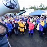
They came from all over the West. One by one they were checked in by Suzi Elle co-owner of Alder Creek Kayak & Canoe and her team of volunteers. The huge canopy of the standard issue commercial grade event tent we rented is flapping hard and occasionally releasing a deluge of water that pooled from the torrential downpours over night. The sea is writhing and folding in on it’s self. You can hear the waves crash against the sand from deep within the Cape Kiwanda RV resort where Lumpy H.Q. is constructed each year. Lumpy seems to have grown a little bit despite our best efforts to keep it small. Now, with over 100 students in attendance, the energy has never felt BIGGER. Enthusiasm permeates the air and ear to ear smiles can be seen all around. Perhaps they have not seen the beach yet? It may be “terrible weather” by most people’s standards, but most people are not wrapped head to toe in Gore-Tex. They don’t mind the rain and they don’t seem to mind the waves either. As the students all gather for the general morning meeting the chanting began, first only softly, then louder and louder…We want Lumpy..We want Lumpy…We want Lumpy…WE WANT LUMPY!!!!!!
-
- Students ripped it up in the short boat surfing classes. Photo by Fred Marmsater
-
- Photo by David Dalbey
-
- The crowd began to chant as one…”We want Lumpy…We want Lumpy…” Photo by Fred Marmsater
-
- The day after the symposium many of the coaches gather for a post event session. Rob Yates throws around the Delphin like one of his play boats. Photo By Alex Stoeffl
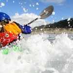
Lumpy Waters is what they want and that’s what we are going to give them! Thanks to an amazing team of coaches (many of which are on the P&H team) and tremendous sponsor support, Alder Creek Kayak & Canoe is able to provide what is becoming known as one of the very BEST rough water symposiums anywhere in the world. It’s a 3 day all inclusive rough water coastal symposium with programs that range from flat water boat control and to advanced long boat surf, navigation and rock gardening rescue classes. The event takes place each Fall out at the coast in Pacific City, Oregon. Team members and ambassadors such as Sean Morley, Rob Yates, Matt Nelson, Bryant Burkhardt, Matt Palmariello, Paul Kuthe and others were there to keep students safe and get them having FUN at the coast, around the rocks, in the surf, and everywhere in between. Thule Racks, Saltwood, Werner, Kokatat, and others were also all there in support.
Events like The Lumpy Waters Symposium and the upcoming Golden Gate Sea Kayak Symposium in 2013 are turning heads and attracting students from around the world. They are raising the bar and taking the sea paddling community in America with them. I’ve never seen so many people excited about REAL sea kayaking. No longer do people hear the word symposium and think of testing shinny new boats in a placid pond. Sea Kayaking is all about paddling in the sea! To paddle safely at sea people need LOTS of training. Rough water events run by well trained and respected coaches and outfitters are a great way to up your game in a reasonably safe environment with new paddling friends and have a great time doing it! We hope you will join us next year.
Watch: The Video
Lumpy Waters 2012 from Fredrik Marmsater Photography on Vimeo.
-Paul Kuthe
The Gales on Lake Superior
Naturally Superior Adventures located at the mouth of the was the host for the 2012 Gale.
The event brought participants from all around the Canadian and United States shores of Lake Superior and the inland sea did not disappoint.
The three day events allowed participants to explore the rocky shores of the lake in calm conditions and also in some interesting conditions. The forecast for all three days were winds greater then 20 knots.
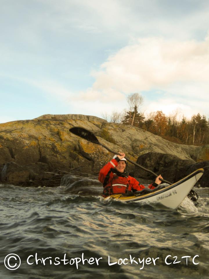
I was joined by several guest coaches Shawna and Leon from Body Boat Blade as well as Nick Cunliffe level 5 BCU coach from Wales as well as a number of local Lake Superior coaches.
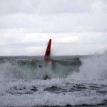
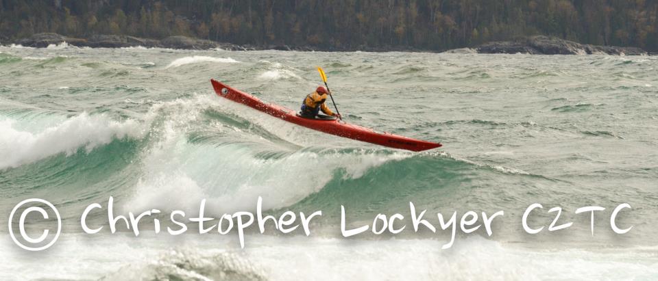
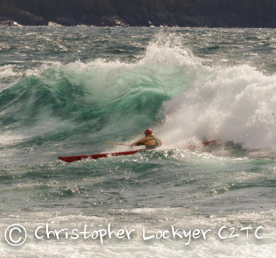
It was a pleasure to paddle with all the enthusiastic paddles. Day one brought flurries for my group and I to start out session, I can honestly say that I have never been blinded by snow flurries why teaching a rock hopping session. Day two stated off at -5 and ice coated sea kayaks and gear. We had a great paddle brown Indian Beach back to the base. The 25 know winds from the west created a very exciting sea state for the participant, we did a great down wind run, surfed at sandy cove and then played in the tide race at the river opening. It was an action packed day. It is the first time someone has told me that it was there best day paddling ever. Not just one but three of the participant came up to Nick and I and told us that directly. It put a smile on my face. Day three brought the largest conditions of the event. Most participant had a go in the surf the retreated to the river as the condition out in front of the lodge reached 12 feet. Nick and Ryan had a go in the surf. The pictures speak for themselves.
Looking forward to the 2013 event in the apostle islands.
http://www.galesstormgathering.com/
For all the pictures from the event please visit this Facebook Gales picture