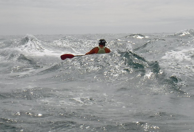
There is more to sea kayaking than just forward paddling. You will enjoy paddling even more when you are fully in control of your boat. You will be able to get closer in and around things when having certain abilities. It’s a lot more fun too. This time we have put some of the most important manoeuvring techniques in one video. It is not a training video, therefor it is to short and it lacks some explanation of the details. But we will let you see what is possible with a sea kayak and a good paddle in your hands. As you can see in our others videos, those techniques are working well in the rougher stuff or in the surf zone. It sure will take some time to master those manoeuvring techniques but it will be worth the while. The video contains footage of some draw strokes, turning a sea kayak, both low and high brace, bow and stern rudder. We filmed from different angles to show you how it’s done. We’ve put a lot of effort and time in this video and we sincerely hope that it may be of use to other paddlers. Paddle safe and take care of each other!
Two years have passed since my last visit to the Oostdyck Radar Tower. Today, conditions were good and so we set of from the Oostduinkerke beach. It is a very good navigation exercise because, although the tower is 36 metres high, you mostly cannot see it until half way. The tower is located not less than 22 kilometres offshore. It’s operational since 2003 and its purpose is to provide guidance for the bigger ocean ships. The international shipping lane is nearby and also the Westhinder anchorage (where ships have to wait for the pilot to come on board). On some days, with extreme good visibility, you can spot the tower from the coast when standing on an elevated position. We have been nine hours on the water to reach the radar tower and get back to shore. Again, it was worth the effort, reaching it and not being able to see the coast! Three hundred and sixty degrees of pure, open water, absolute peace and quiet…… The tower itself is unmanned.
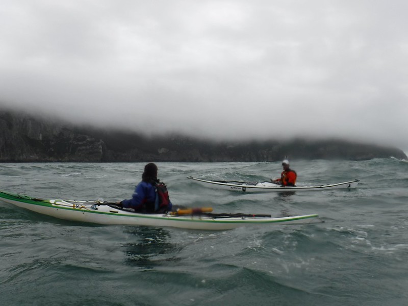
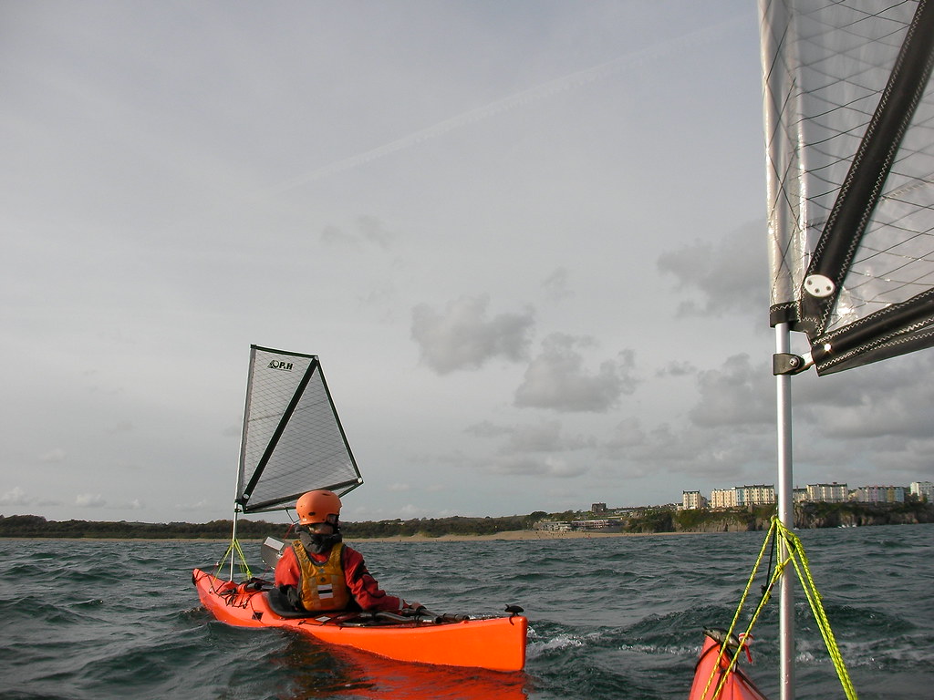
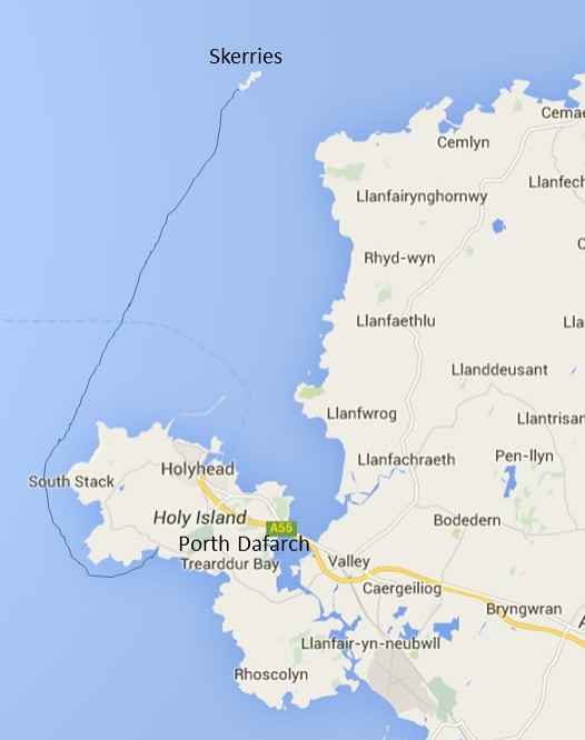
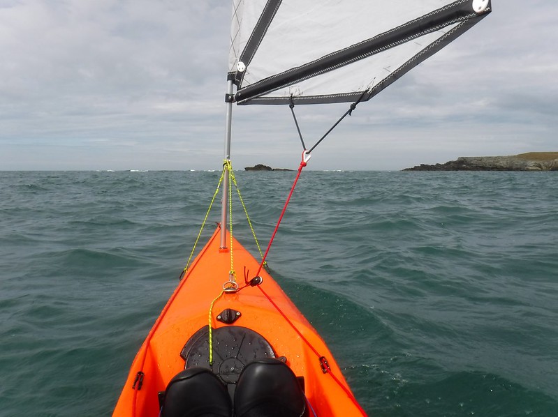
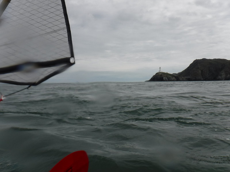
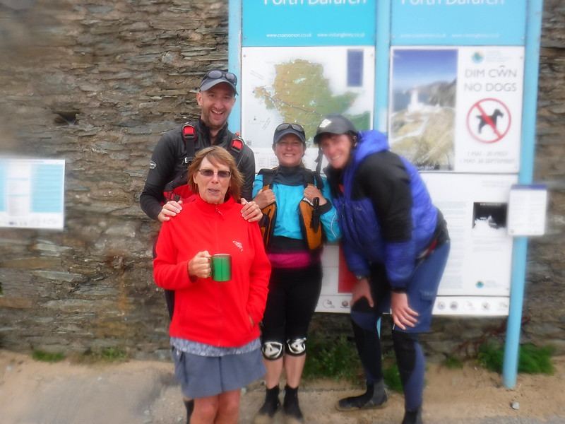
29 July Porthdafarch – South Stack, via Penrhyn Mawr, with Ed Loffill
2 August Soldiers Point – South Stack, via North Stack with Ed Loffill and Justine Curgenven
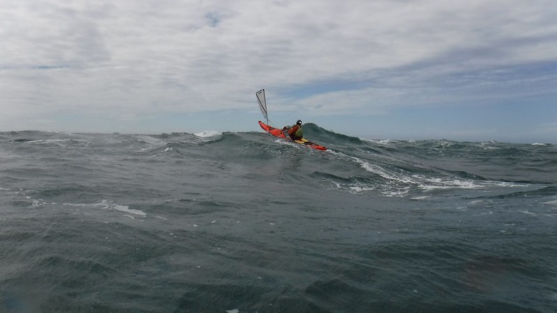
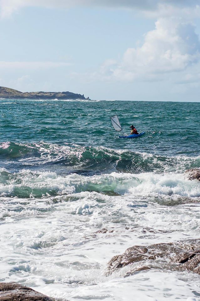
Sea Kayak Sailing/Surfing at Penrhyn Mawr
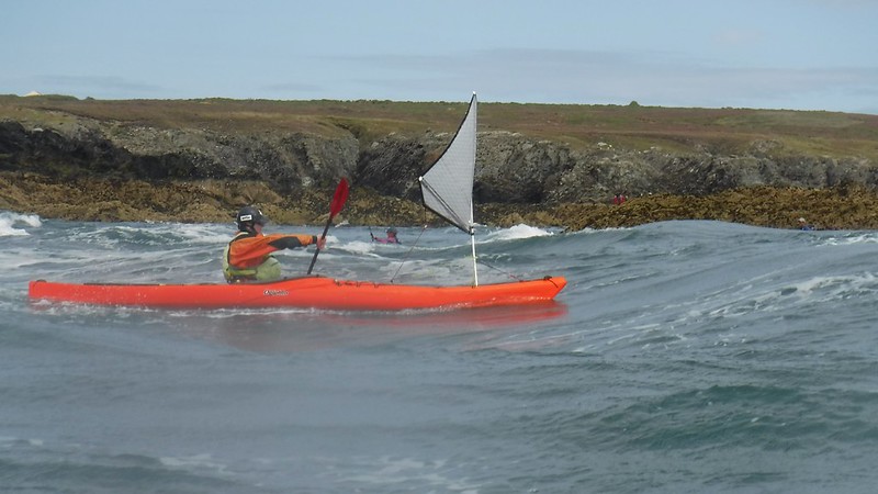
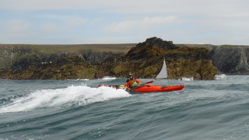
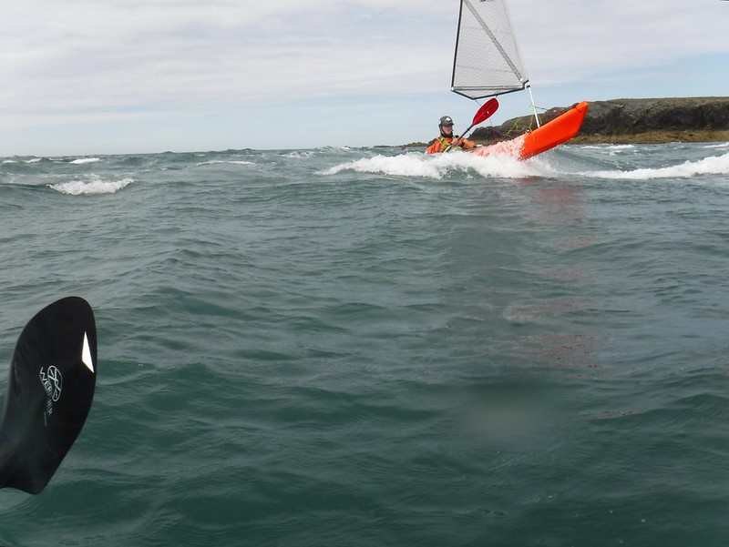
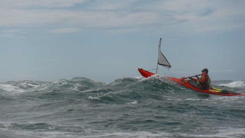
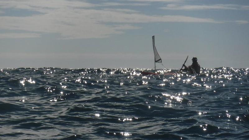
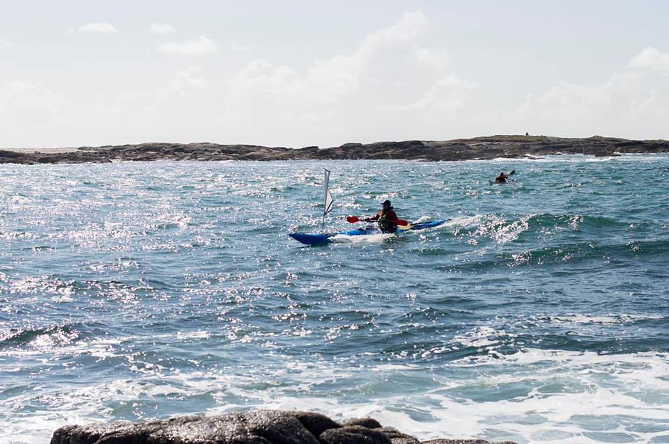
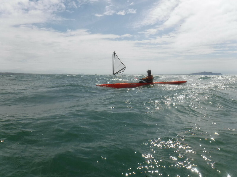
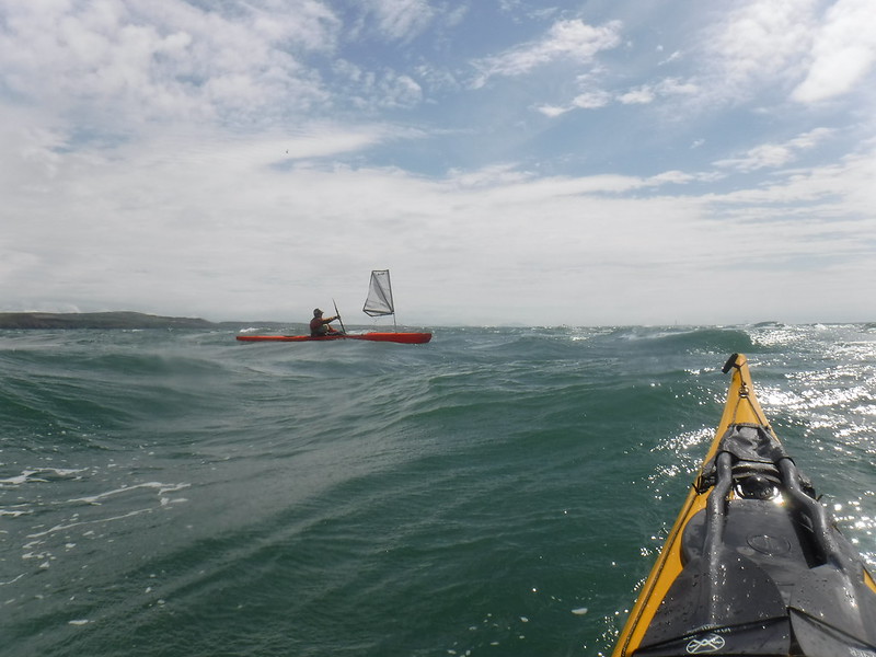
Sea Kayak Sailing/Surfing at South Stack
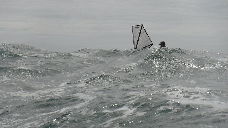
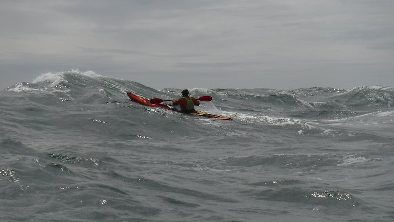
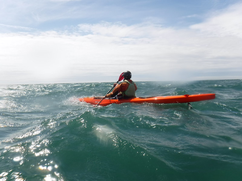
The sail was taken down for surfing steeper waves at South Stack
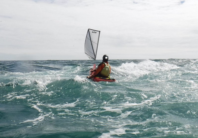
The sail back up to surf closely past South Stack’s headland
Beam reach sailing back to Porthdafarch
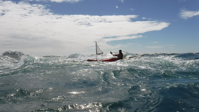
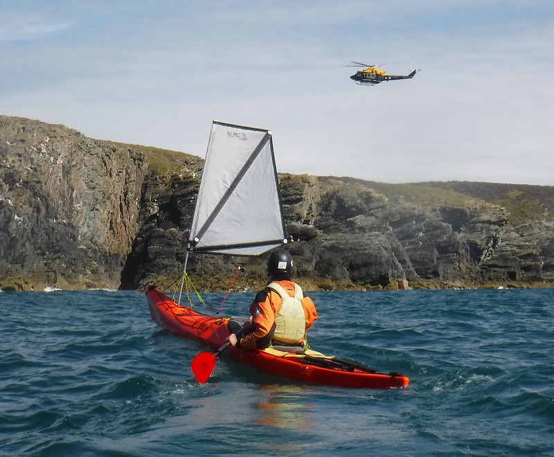
South Stack with Ed and Justine
The Delphin MKII CoreLite X
The biggest improvement I found in the Delphin MKII CoreLite X is the extra speed and responsiveness it has in surf. This is thanks largely to the greater stiffness in the plastic construction. The cockpit has also been improved to provide better comfort and connectivity. The day hatch is a welcome addition, as are the sailing fittings. In summary, the Delphin MKII CoreLite X has all of the great features of the original Delphin but with some very useful additions/refinements and stiffer plastic for even more fun surfing.
Sea Kayak Sailing in Tideraces
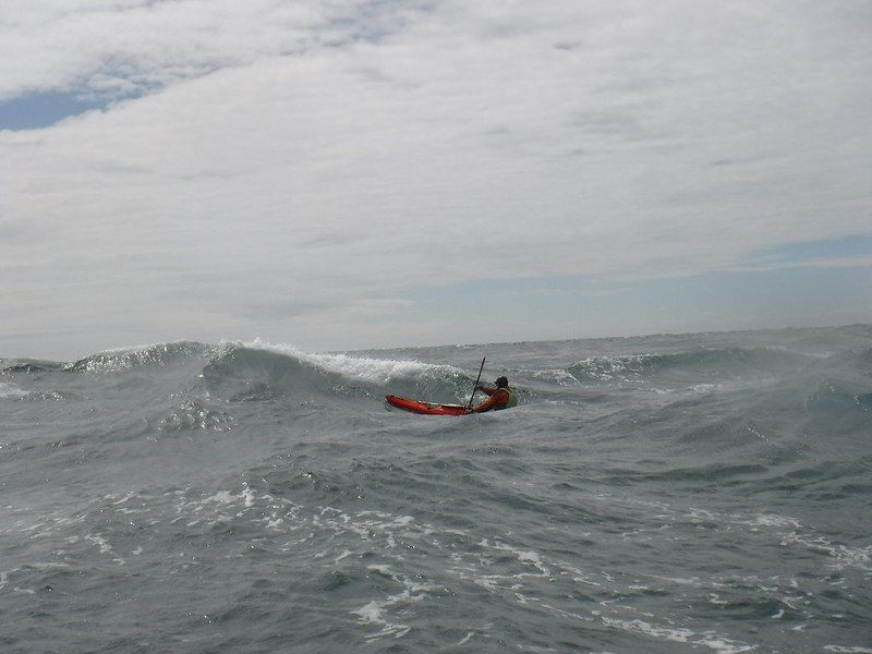
It is a bit of a balance whether/or not to deploy the sail in a tiderace. When the waves are not particularly steep the addition of a sail makes catching waves far easier, increasing the number of surfable waves and the length of the runs. At some point the balance between fun and fear will probably tip towards fear, or at the very least uncomfortableness. It is now time to take the sail down as the surf has steepened up and you probably don’t need any more help catching the waves.
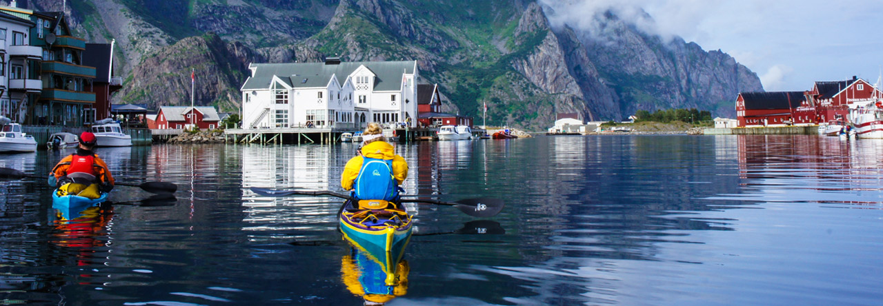
It has been a while since we have been on the water together. So today, we planned a little daytrip to Northern France, more specific Cap Gris Nez. It is located along the Dover Strait (Pas de Calais) on the French side of course and is known for its strong tidal current and fast changing weather. We planned on paddling near the rocks and cliffs around high water. While it was very sunny the first part of the trip, weather began to change very fast (within 30 minutes) and a sea fog set out all over the area. When in the neighbourhood with a kayak on the roof of your car, make sure to stop by and enjoy the scenery (and meet the grey seals that live there)!
Sea kayaks enable their users to explore and play on life-affirming journeys. Part of the challenge is to safely utilise the currents, swell and winds. The direct energy of the wind has been largely unused by most modern sea kayakers. In recent decades sailing rigs have become far more manageable to use on sea kayaks and their distribution/availability outside of Australia and New Zealand is only now becoming a reality. This exciting development is opening up brand new sea kayaking opportunities and challenges for all. From downwind coastal runs to traversing huge exposed island chains, like the Aleutians, sea kayak sailing is putting bigger smiles on people’s faces and aiding in epic journeys.
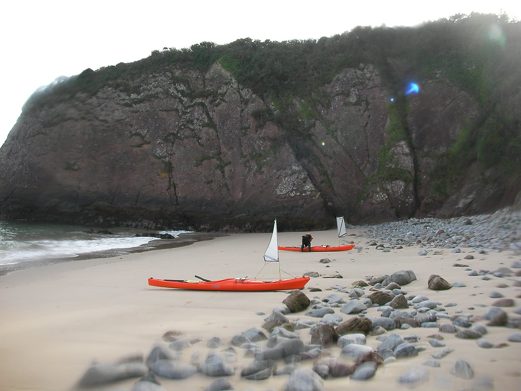
Tropical beach on Caldey Island
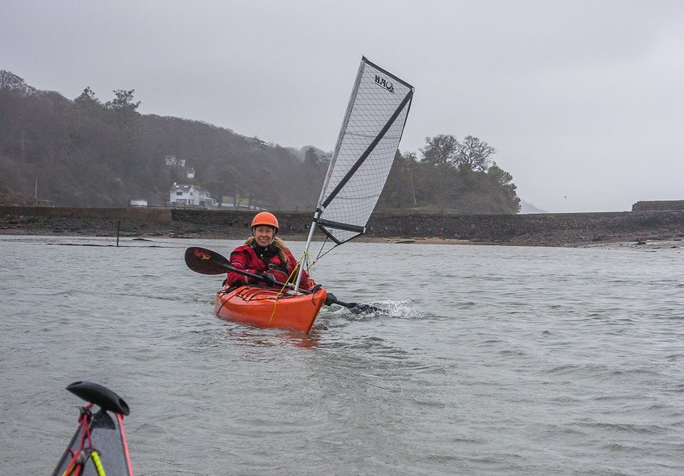
Windy day at Cadnant Bay Menai Straits
History
Kayak sailing was invented in 1865 when John “Rob Roy” MacGregor designed and built a sailing kayak for his 1,000 mile journey along the inland waterways of Europe. Those early Rob Roy Kayaks subsequently evolved into the huge variety of kayak types that we know today. Sail equipped kayaks remained popular into the 1930s. In 1934, Alastair Dunnett and Seumas Adam (“The Canoe Boys”) used their sail equipped Lochaber kayaks on an impressive and pioneering journey to explore the west coast of Scotland.
Kayak sailing also became popular in continental Europe during the 1920s and 1930s. In 1928 Franz Romer kayak sailed across the Atlantic from Lisbon to Puerto Rico. He attempted to continue his journey onwards to New York but went missing, presumably killed, in a hurricane. Oskar Speck’s similarly epic seven year kayak sailing trip from Germany to Australia should have been widely celebrated as an amazing achievement. However, arriving at his destination in September 1939 he was interned for the duration of the Second World War.
Kayak sailing subsequently went out of fashion in Europe. Towards the end of the twentieth century sails were beginning to be developed for use on modern sea kayaks by Australia and New Zealand-based kayakers. Sea kayak sailing is now commonplace in these countries and is beginning to take hold in Europe and North America.
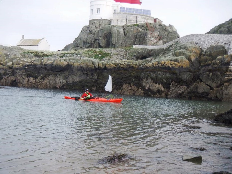
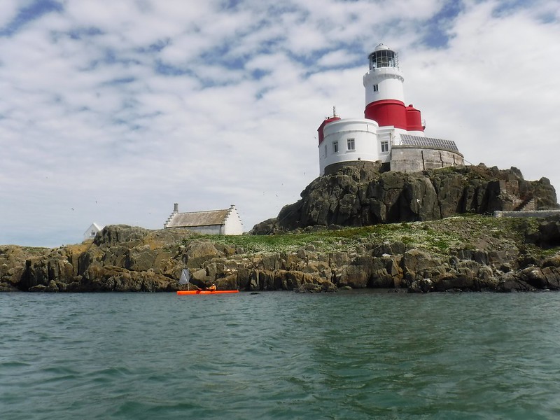
Skerries Lighthouse, Anglesey
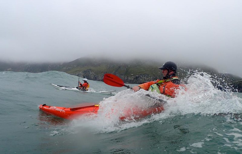
Surfing in Ireland
Surfing near Stackpole
Why sea kayak sail?
Speed/endurance/fun
Maintaining the top displacement hull speed is easier when sea kayak sailing. It is also much easier to get your kayak planing in swell and tidal rapids. This is particularly useful when attempting to catch less steep waves. In essence you will catch more waves, considerably increasing your speed and range. Average speeds of 7 knots with planing top speed runs in excess of 10 knots are not unusual in conditions where it would be considerably more difficult for conventional sea kayaks to plane and maintain average speeds of more than 3-4 knots.
When the waves become too steep it is best to stow the sail away as it will no longer enhance the experience and will, most likely, become a liability.
Enhanced safety
The sail appears triangular and conspicuous from afar and/or in overhead rolling swell.
The exposure of paddling along coastlines with less frequent safe landings is reduced if the wind and sail combine to add to the kayaks propulsion.
Caldey Island tiderace
Getting into sea kayak sailing
Equipment
The main airfoil sail available in Europe is the Flat Earth Kayak Sails range of airfoils. They are designed and manufactured in Australia by Mick MacRobb. Other airfoil sails are being manufactured for sea kayaks but they are far less common in Europe.
Sea kayak manufacturers
Many composite sea kayaks will need strengthening in order to accommodate a sail mast. You can assess this by pressing down on the deck near the compass recess and gauging whether there is much flexibility in the deck and hull. Most kayak companies will strengthen your kayak by special order. Plastic kayaks tend to be more robust in taking a sail mast.
Since 2012, P&H kayaks have produced all of their composite kayaks with enough strength to accommodate a sail mast. Their plastic Scorpio MKII range of sea kayaks has been designed with sailing in mind. It easily accommodates a Flat Earth Sail and handles superbly well when sailed.
Have a go/purchase
Scotland – Karitec are the main UK distributor of Flat Earth Kayak Sails and have a range of demo boats to try out under sail.
Wales – Sea Kayaking Wales (SKW) are based on Anglesey and have a range of P&H sea kayaks and Flat Earth Kayak Sails to try out. SKW also run sea kayaking (including sailing) courses in Ceredigion, Pembrokeshire, Llŷn and the Gower. Flat Earth Sails are available to purchase from SKW.
http://seakayakphoto.blogspot.co.uk/ – An excellent blog written by, Douglas Wilcox, one of the most enthusiastic proponents of sea kayak sailing in Europe.
After paddling the Octane on Llyn Padarn I wanted to try it out at sea in wind, waves and moving water. My kayaking buddies for this trip were Ed and Abi Loffil.
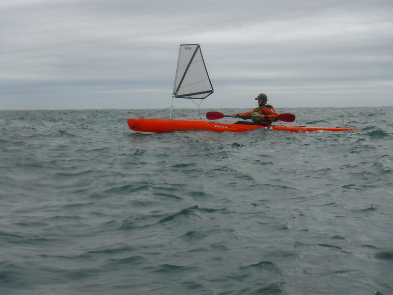
The Pyranha Octane with the Flat Earth Sail fitted
Ed and Abi had a head start on the outward leg so I followed them 20 minutes after their departure. This leg had up to 10 knots of southerly wind with a slightly post spring tidal current to propel us on the flooding tide to The Skerries. Time of leg – 1.5 hrs.
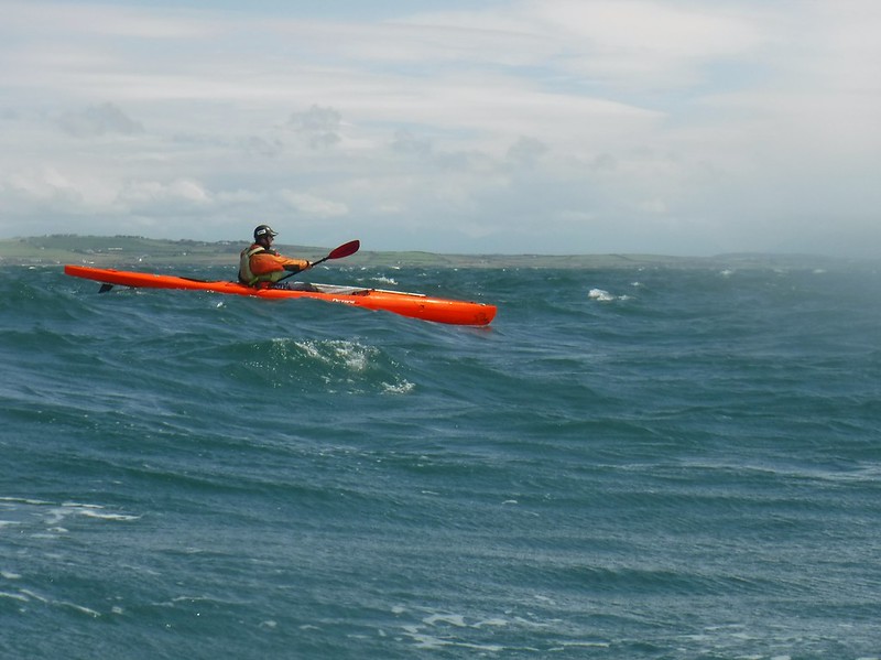
Approaching Penrhyn Mawr
Approaching the middle race of Penrhyn Mawr
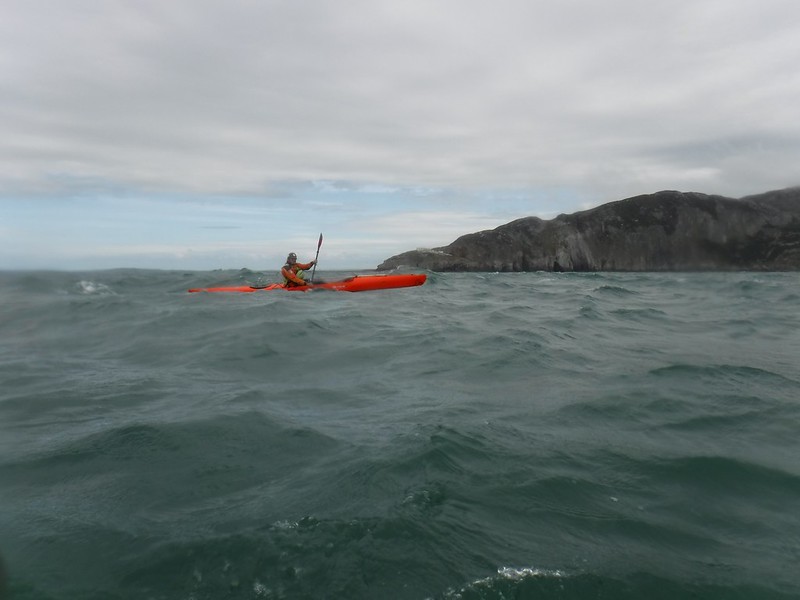
South Stack
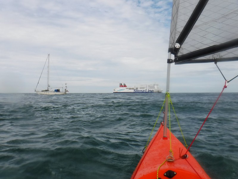
Rush Hour in Holyhead Bay
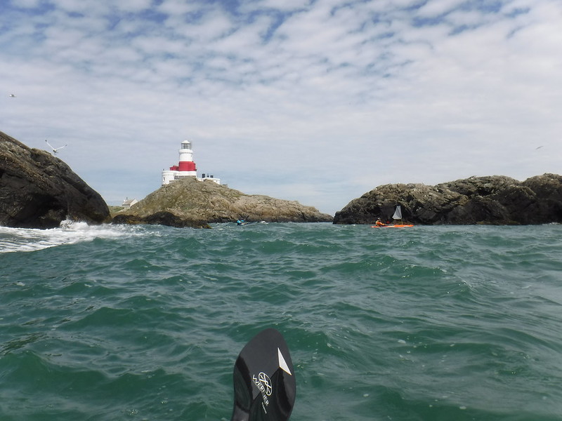
The Skerries
Departing The Skerries
Surfing circuits at The Skerries
The return leg had 10-17 knots of southerly wind against the south flowing ebb tide. Time of leg – 3 hrs.
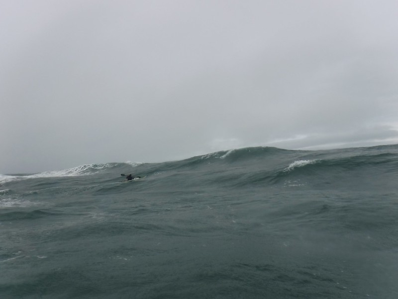
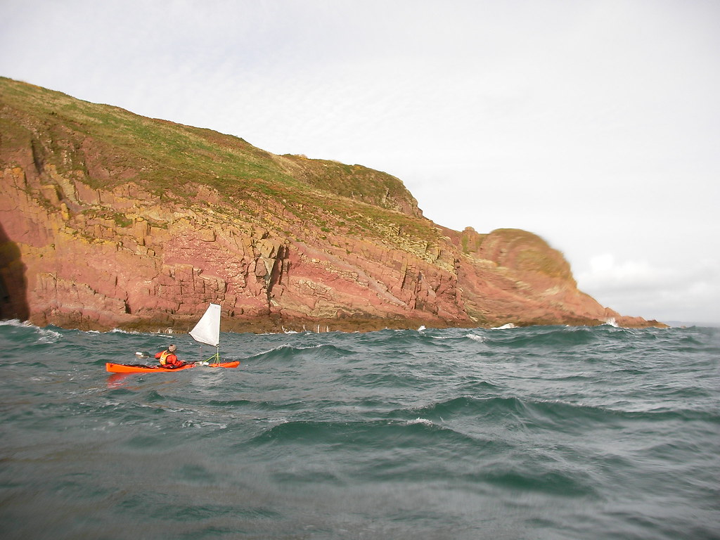
The rough journey back south
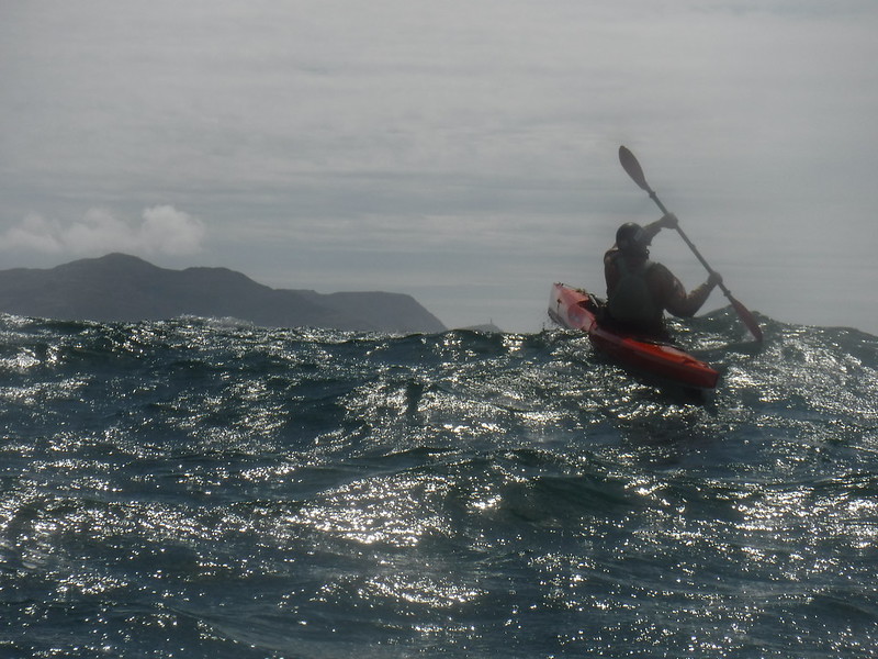
North Stack
Taking a rest at South Stack
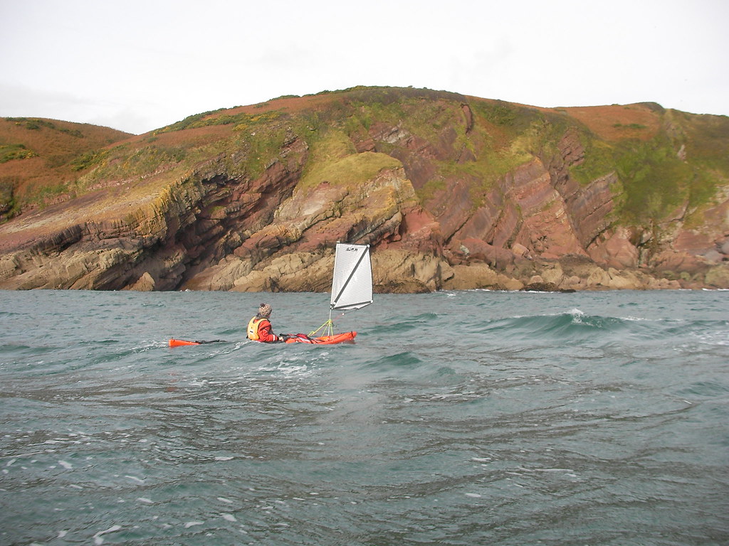
Sailing home to Porth Dafarch
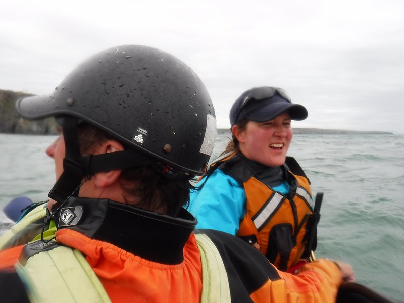
The team returned at Porth Dafarch with our paddling friend Jan
Initial thoughts on the Octane
Previous to receiving the Octane I had never paddled a surfski. The closest speedy boat I had experienced to compare it to is the Rockpool Taran. The Octane, like the Taran, is great fun to paddle fast, especially in surf. At speed the surf ski is particularly stable, locking into its watery path. Its stability seemed further enhanced with the addition of the Flat Earth Sail, as this gave more propulsion. It is even better to sail than the equivalent P&H Scorpio or Delphin sailing kayaks as it is super quick and responsive to the rudder. With its open cockpit it felt a lot like a modern sailing dinghy, especially with the gurgling sound of the self-bailer.
Paddling downwind with swell was far, far better than the reverse into wind and waves. The former situation gave much greater speed than the accompanying sea kayaks, whereas into wind and swell the surfski was only marginally quicker, despite lots more effort from my core muscles. I probably need to improve my technique in these conditions.
The Octane is a very positive boat. It rewards good posture and technique with better performance. This feedback is proving really useful as I try to get better at paddling a surf ski.
When I was looking to replace my trusty P&H Scorpio Lv with a Cetus I spend hours looking on the internet to find footage where I could see the boat in action. I know what you’re thinking, why not testing it rather that looking at videos? Well, I already did and I was sure that the Cetus was going to be my next boat. The kayak customizer page on the P&H site is awesome, I think I made my boat virtually one hundred times. But it’s even better to see the boat on the water, with a paddler in it. To see it’s colours, to see the different options, to see its behaviour,… Even when waiting on the delivery I searched “Cetus videos”. The only downside was that there are not many to be found where you can see the boat from different angles. So I remained a bit unsatisfied for the time being…
With the delivery I felt like a kid with his new toy (and I still am by that matter). It was my first composite boat, new, shiny, glossy! I already paddled several hundred kilometres with it, in a wide variety of conditions. Just like its polyethylene brother, the Scorpio, it never lets me down. On the water it has to perform, it goes fast while being stable, very stable. Even when paddling in rough seas it still feels like I am paddling from my couch. When putting it on edge it steers and turns very well. Anyway, don’t take my word for it. I am perhaps a tiny bit subjective. When looking to buy a quality sea kayak, make sure to test this piece of craftsmanship and see for yourself!
Enjoy our short video, a big thanks to Sylvie, who filmed from different angles to get the best result.
Paddle safe and take care of each other on the water!
The British public have spoken, and they’ve elected to leave the European Union.
The full effects of Brexit are yet to be seen, and this resultant uncertainty in the UK’s political climate has led to a significant fall in the value of the Pound in relation to both the Dollar and the Euro.
For non-UK manufacturers, this means their products have become much more expensive when imported to the UK market, whereas our products (proudly made in the UK since 1971) have remained at the same price to our UK customers, and are now even better value to those in the US, EU and further afield.
However, this won’t last; although we manufacture all of our products in the UK, many of the raw materials and much of the packaging are oil-based, and as oil is traded in Dollars, the cost of these is sure to rise in the next few months once our pre-agreed contract pricing comes to an end.
If you’re asking yourself, ‘Is now the right time to buy a kayak?’, the answer is a resounding yes, as no one can predict by how much prices of the raw materials that go in to a kayak will rise, but as the margins we make on them is minimal, these price rises are sure to affect the consumer.
There has never been a better time to buy a British Canoe or Kayak, check out the P&H Sea Kayaks range now.
The Cetus MV was, yet again, my boat of choice to meet all my coaching and personal paddling needs for this year.; whether it is introducing aspiring sea kayakers on sheltered waters, running 5 Star courses in the Pentland Firth, away on expeditions around Scotland’s amazing coastline or playing out at the Grey Dogs, for me, it just does it all. It also gives me a real stable platform for on-the-water-photography when doing my books, articles and sponsors’ photos; with an expensive SLR digital camera in my hand, and the opportunity to capture that ‘perfect front cover picture’, that’s pretty important!
So, when my latest Cetus MV arrived the other week, as always I was excited to get it out on the water, but this boat was just that little ‘more’ special; PeakUK have updated the colours on their sea range of kit this year, and knowing this, it seemed rude not to have a boat to match! With some helpful collaboration between PeakUK and P&H, the colours were matched and that allowed P&H to do their ‘magic’ in customising the perfect boat for me! As you would expect, they really went to town on it and not only was the boat colour matched, but all the trimmings (decklines and bungees) as well – brilliant!!
With the perfect boat from P&H and the awesome kit from PeakUK, a suitably spectacular venue was required for its first outing, along with some great light to get the photos to show it off; the North West Highlands of Scotland were the destination and the amazing Island of Handa was the prime spot to visit. If you’ve not been to Handa yet – go… It offers towering cliffs, caves and arches aplenty, along with the enormous ‘Great Stack’ of Handa. All this is guarded by thousands of sea birds, with the raw force of the Atlantic Ocean on one side and the relative shelter and beaches of the Sound of Handa on the other. It’s easily accessible to paddle around, yet once there you will feel on the edge of the world in a very exposed way!
So, with some careful weather watching, some great evening light was found to paddle around Handa Island and ‘wet the hull’ of my rather unique boat – may she see many more such great trips in the months to come… thanks to all the P&H team for making her so brilliant!!
Ik heb gedroomd. Ik heb hard getraind. Ik heb mij goed voorbereid. Ik heb op 30 en 31 juli 2015 de Noordzee overgestoken per zeekajak, enkel op spierkracht, alleen en zonder begeleiding of ondersteuning van een ander schip. Ik heb ’s nachts en overdag gevaren, ik ben mezelf tegengekomen, ik heb gejubeld en gevloekt! Dit is het verslag van mijn North Sea Crossing.
Ik ben fervent zeekajakker en droom er al jaren van om de oversteek te wagen tussen Engeland en het vasteland. Wat ik absoluut niet wou is het Kanaal oversteken gezien dit niet aanzien wordt als een “open zee” oversteek. Ik opteerde om de verbinding te maken tussen twee zeehavens en hierbij het zuidelijkste gedeelte van de Noordzee over te steken. Aan deze oversteek gingen twee jaar planning en voorbereiding vooraf. Diverse vooropgestelde data gingen helaas voorbij zonder dat de meteorologische omstandigheden voldoende gunstig waren voor dit huzarenstuk. In de week vlak voor de oversteek bleek het weerbeeld voldoende gunstig en stabiel om de laatste voorbereidingen te treffen. Toch diende ik één dag uit te stellen door onweer.
Tochtverslag:
Op 30 juli 2015 was het eindelijk zover. Hoewel ik zelfzeker was heb ik de nacht ervoor bijna geen oog dicht gedaan. In mijn geval blijkt dit echter volledig normaal. De oversteek is geen klein tochtje meer te noemen. Vlak voor vertrek lichtte ik Oostende Radio/Kustwacht en de Dover Coast Guard in omtrent mijn bedoelingen. Zij beschikken over een vaarplan en de verwachte aankomsttijden bij de diverse boeien en bakens. Mijn vrouw Sylvie was mijn ondersteuningsteam te lande en zou gedurende de tocht contact onderhouden met beide diensten. Om 21:30 uur stipt vertrok ik in de haven Nieuwpoort, na afscheid genomen te hebben van mijn vrouw en kinderen en mijn ouders. Het was mijn wens om zo weinig mogelijk mensen op voorhand in te lichten om het vertrek minder zwaar te maken. Ik voer de haven buiten, langsheen het staketsel van Nieuwpoort waar ik door mijn familie een laatste maal uitgezwaaid werd. Ik zette mijn koers uit richting de boei Trapegeer en tot daar kon ik nog profiteren van een sterke getijstroming in mijn voordeel. De zon was dan al een tijdje weg, de duisternis was mijn stille metgezel. Er stond een volle maan, dit kwam de zichtbaarheid ten goede maar dat wil ook zeggen dat de stroming sterker is (springtij). Vanaf de boei Trapegeer keerde het getij en heb ik tegen deze zéér sterke stroming moeten opboksen gedurende een zestal uur, non-stop. Ik kwam tijdens de nacht slechts één schip tegen, hoewel mijn verlichting steeds aan en in orde was stak ik hier veiligheidshalve even mijn stroboscoop aan gezien het visserschip even op ramkoers lag. Het schip wijzigde zijn koers hierna.
Op 31 juli 2015 om 04:48 uur kwam ik aan bij de boei DY1, al een gans eind in de Franse wateren. Ik kon hier een allerlaatste maal mijn positie en toestand doorgeven aan radio operator Marc van Oostende Radio. Het was de laatste vriendelijke stem die ik de komende uren zou horen. Mijn afgelegde afstand was op dat moment 35 km.
Na de boei DY1 begon de stroming stil te vallen en uiteindelijk te keren in mijn voordeel. Dit was precies volgens mijn berekeningen. Ik lag ook al voor op mijn planning wat positief was. Ik heb de zonsopgang nog meer weten te appreciëren bij deze tocht, ze was prachtig op volle zee. Ik passeerde de boeien Ruytingen SE en Ruytingen NW in de laatste aanloop naar de internationale scheepvaartroute. Ik nam slechts korte pauzes om het uur om snel iets te eten en te drinken. Vanaf de boei Ruytingen NW begon het middelste gedeelte van mijn oversteek; het kruisen van een enorme snelweg midden op zee. De vaarroute is te vergelijken met een autosnelweg, volgens cijfers van de Dover Coastguard passeren hier per 24 uur gemiddeld 500 grote zeeschepen. Deze geul is ongeveer 20 km breed op het punt waar ik over moest. Snelheid is van het grootste belang alsook aandacht voor de scheepvaart. Grote schepen zien mij NIET! Ik dien zelf alles in te schatten en indien nodig mijn koers te wijzigen. Het eerste gedeelte naar de boei Sandettie WSW ging als vanzelf, ik kwam géén enkel schip tegen. Toen ik over de Sandettie Bank voer was het alsof er branding in volle zee stond! Ik kon er zelfs surfen!
Hierna diende ik de tweede en laatste vaargeul te kruisen tot aan de boei South Falls. Ik had de stromingen zéér goed ingeschat. Deze zijn er bijna dubbel zo sterk als voor onze eigen Belgische kust. Hier diende ik even haast te zetten voor vier aankomende zeeschepen vanuit de NW-richting. Gevaar was er echter nooit, ik kon er ver genoeg vandaan blijven.
Het moment dat mij het meest is bijgebleven is toen ik voor het eerst weer opnieuw land zag! De kliffen van Sint Margarets at Cliffe nabij Dover zijn al van ver te zien! Dit was toen ik net de boei South Falls passeerde. Fantastisch!!!
Vanaf de boei South Falls ben ik voor het eerst van mijn geplande route afgeweken. Ook dit was doorgeven aan mijn vrouw. Ik had vooraf een secundaire route opgesteld indien ik voorliep op mijn initiële planning, dan zou de stroming nog anders zijn. Ik zette koers naar het E Goodwin lichtschip in plaats van de E Goodwin boei. Ik bereikte het onbemande lichtschip op 31 juli 2015 om 11:45 uur (Belgische tijd) en kon er voor het eerst sinds boei DY1 uren geleden radiocontact maken met de Dover Coastguard. De vriendelijke radio operator kon er ook mijn toestand en positie doorgeven aan mijn vrouw Sylvie. Het Goodwin lichtschip ligt op een 14 km offshore en is de aanduiding voor de scheepvaart voor de Goodwin Sands. De Goodwin Sands vormen een gevaar voor de scheepvaart gezien hun geringe diepte en onvoorspelbare zeegang, een deel van de banken komt zelfs boven bij eb. Perfect dus voor een getrainde zeekajakker om over te varen, wat ik dus deed. De banken lagen volledig onder maar de zeegang was fenomenaal. Er was vrijwel geen wind maar door de sterke stroming stonden er brekende golven van ca. 1 m hoogte! Een uitdaging, maar enorm lonend! Gek om na zo’n afstand nog steeds energie te vinden om te surfen op meer dan 10 km van de Engelse kust!! Ik kwam er nog een tiental zeehonden, zowel gewone als grijze, tegen die bij laag water komen rusten op de banken.
Zoals men zegt, de laatste loodjes wegen het zwaarst….. Er zit waarheid in, de stroming was vanaf daar opnieuw in mijn voordeel, maar zo sterk dat ik onder een grote hoek diende bij te sturen om de haven van Ramsgate nog te bereiken. Ik voer de haven binnen in alle rust. Ik lag zo ver voor op mijn planning dat zelf mijn ondersteuningsteam nog niet ter plaatse was. Sylvie had oponthoud in de haven van Calais voor enkele uren, door problemen met vluchtelingen. Ik kwam aan bij de enige kleine slipway die de haven van Ramsgate rijk is op 31 juli 2015 om 15:06 uur (Belgische tijd).
Ik ben aan de slipway enkele uren gebleven tot de komst van Sylvie. Gelukkig was ik zoals altijd goed voorbereid, ik had extra kledij mee en ook voldoende drank en voedsel. Ik heb er met veel smaak een portie spaghetti verorberd die ik met mijn brandertje opwarmde. Daarna kon ik even rusten om uiteindelijk mijn vrouw en kinderen weer in de armen te sluiten en terug huiswaarts te keren met de ferry.
Slot:
Pas bij dit schrijven begint het mij door te dringen wat ik verwezenlijkt heb. Ik voel elk spiertje nu in mijn lichaam. Ik ben, zelfs na 12 uur slapen, nog moe. Maar ik ben vooral blij! Ik ben trots op deze sportprestatie. Hier telde niet alleen de afgelegd afstand, maar ook het zeemanschap en de kennis en kunde om goed te navigeren en de juiste beslissingen te nemen op het goede moment. Niet alleen het fysiek in staat zijn om meer dan 100 km te peddelen in één trek, maar ook de mentale toestand om moederziel alleen en zonder enige vorm van ondersteuning of begeleiding de overtocht te maken geven mij enorme voldoening! Alles bij zo’n tocht valt of staat met je eigen voorbereiding en training! Als extraatje voor mezelf komt er nog bij dat ik de oversteek in een kortere tijd heb kunnen doen dan dat ik vooraf had gepland!
Ik wens hierbij mijn vrouwtje Sylvie te bedanken voor haar grenzeloze ondersteuning bij al mijn zotte ondernemingen! Zonder haar was dit niet mogelijk geweest! Hetzelfde geldt voor de weinige mensen die vooraf op de hoogte waren van mijn onderneming, bedankt voor jullie komst bij vertrek, alsook voor de talrijke lieve telefoontjes en berichten! Bedankt aan radio operator Marc van Oostende Radio die mijn bewaarengel was tot aan de DY1 boei! Hetzelfde geldt voor de al even vriendelijke crew van de Dover Coast Guard, zij waakten over mij van het Goodwin lichtschip tot de haven Ramsgate!
Ik hoop tevens met deze tocht het Belgisch zeekajakken in de kijker te plaatsen. Het is niet omdat we een relatief korte kustlijn hebben dat we niet in staat zijn grootse dingen te doen! We blijven naar goede gewoonte elkaar en andere zeekajakkers ondersteunen met onze NORTHSEAKAYAK-groep!
Technische fiche:
De GPS die de tocht registreerde werd niet afgelegd gedurende de ganse onderneming. De gegevens zijn hiervan afkomstig en aldus correct.
Totale afstand: 106,7 km
Totale tijd: 17uur36min
Gemiddelde snelheid: 6,1 km/h
Maximaal geregistreerde snelheid: 13,5 km/h
Gebruikte kajak: P&H Scorpio LV (Polyethylene)
Gebruikte peddel: Vertical Elements Explorer Aircore Pro full carbon
Complete veiligheidsuitrusting met oa PLB (Personal Locator Beacon), 2 VHF radio’s, vuurpijlen, extra verlichting,….